Weather

Actions

Red Flag warnings in effect for weekend

Saturday Morning Weekend Forecast
Posted

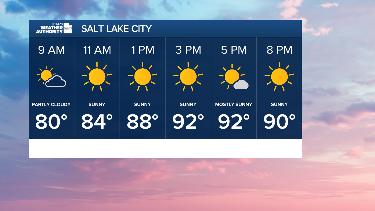
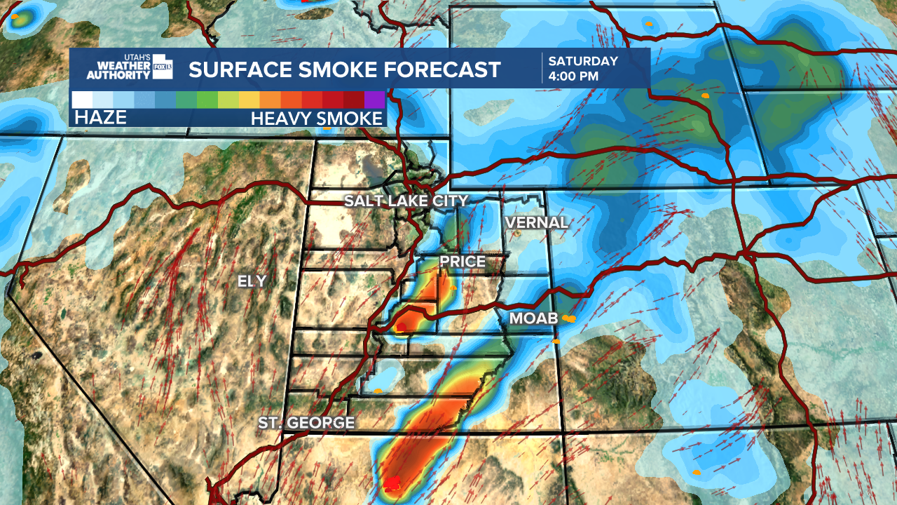
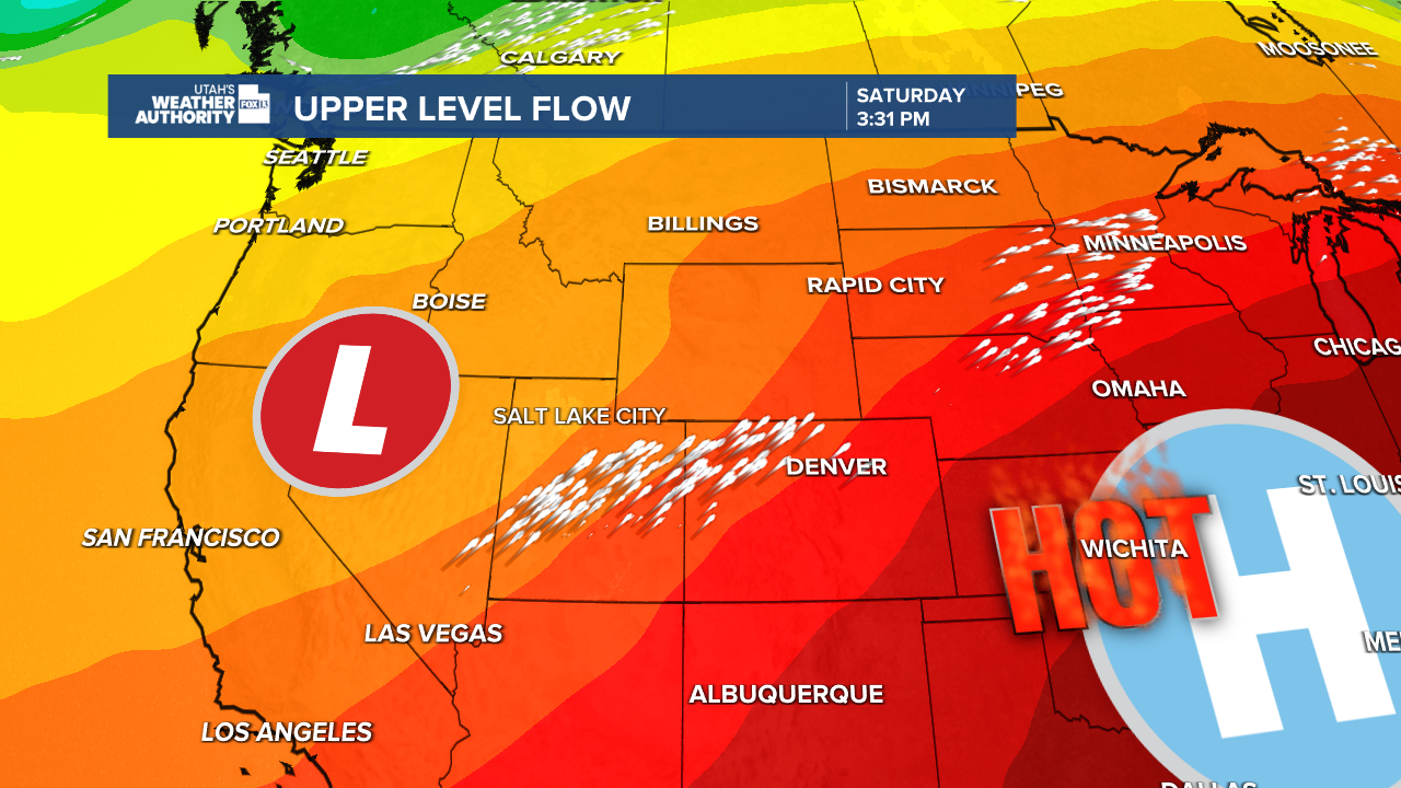
Clouds over northern Utah this morning are clearing, and hazy sunshine is expected for the remainder of Saturday. Temperatures remain hot and near average for this time of year as southwest flow remains in place.

Graphics from the FOX 13 Weather Center showing the hour by hour forecast for Salt Lake City, showing 80°F by 9 AM, 84° F by 11 AM, 88­° F by 1PM, 92° from 3 PM through 5 PM, and 90° F by 8 PM.

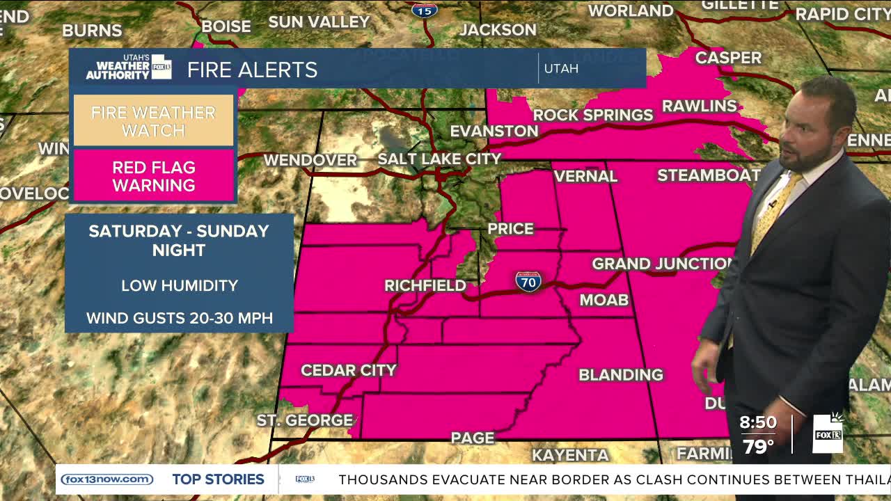
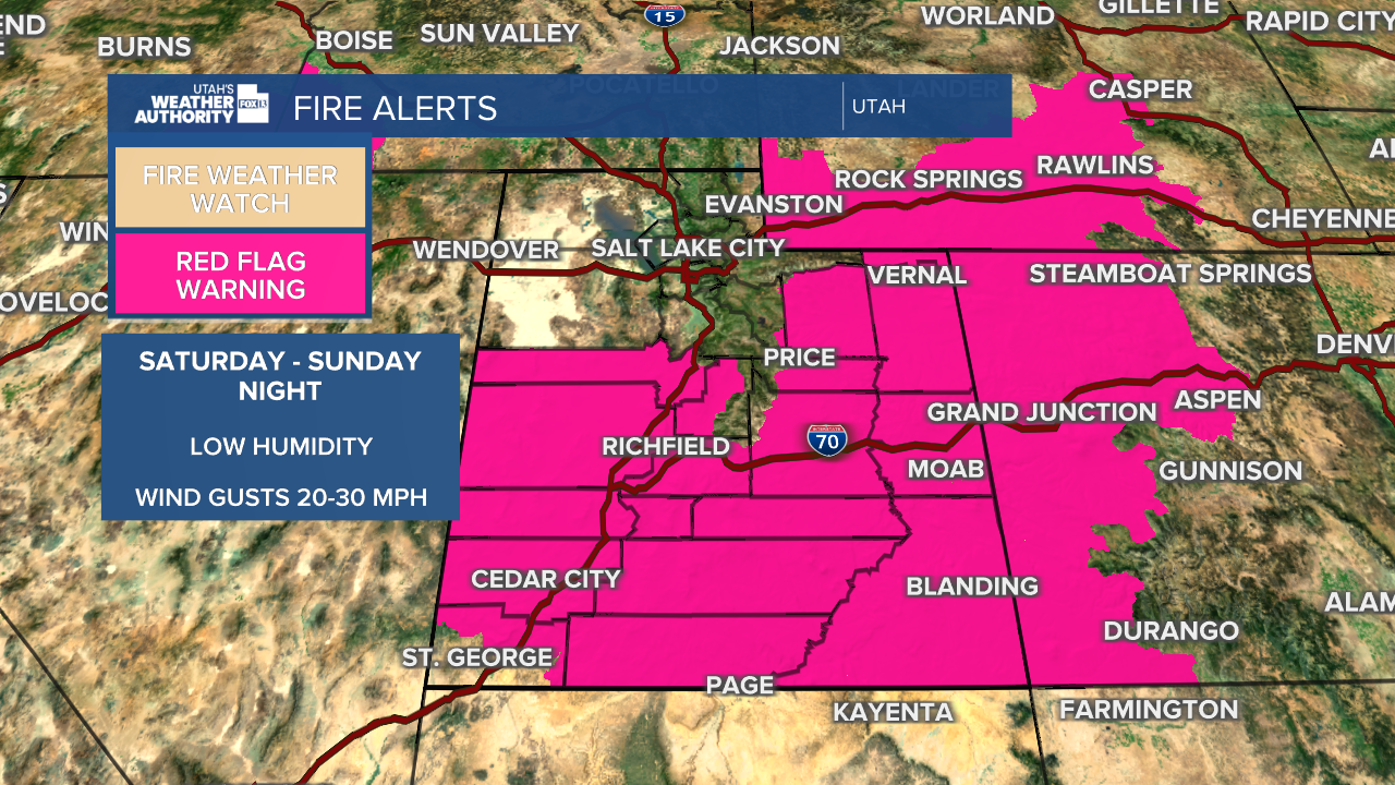
A passing trough to the west will increase wind gusts throughout the weekend, and fire weather is expected to remain critical for the eastern and southern parts of the state.

Graphics from the FOX 13 Weather Center showing areas where smoke is expected. Two hot spots are shown just south of Utah up through Kane County and in central Utah, spanning from Sevier, Sanpete, and Emery Counties.

Wind gusts up to 30 mph are expected with low relative humidity, down to 6%, in the afternoons. Red Flag Warnings go into effect at noon Saturday and will remain in place through 9 pm Sunday.

A graphic generated at the FOX 13 Weather Center showing the areas where red flag warnings have been issued. It's a map of Utah and some surrounding areas. Most of the state is covered in pink, showing where the red flag warnings have been issued. The only areas not covered include one south west corner of Utah below St. George, and a northern section of the state that includes Salt Lake City and Wendover.

Little change is expected in the next week, with mainly hot and dry weather continuing. Peak heat will arrive on Tuesday, where highs will reach the upper 90s for the northern valleys, near 104 in St. George.

Graphics from the FOX 13 Weather Center showing the past of the Upper Flow. Low pressure hangs over the areas west of Utah, with the flow path crossing over both Utah and Colorado.

Models are hinting at some moisture moving into the region by Thursday, which could lead to isolated showers and thunderstorms across southeast Utah. Stay tuned.

Graphics from the FOX 13 Weather Center showing the temperatures forecasted for the day. From top to bottom, left to right: Elko 90°, Wendover 94°, Ogden 92 °, Logan 91°, Salt Lake City 94°, Evanston 82°, Ely 84°, Delta 92°, Provo 92°, Park City 81°, Vernal 89°, Price 89°, Milford 91°, Cedar City 85°, Richfield 89°, Moab 96°, St. George 99°, Kanab 92°, Bullfrog 97°, Blanding 91°

SALT LAKE CITY
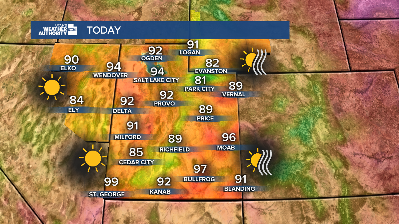
Saturday: Sunny and breezy. Highs: Mid 90s (around 94 °).
Saturday Night: Mostly clear. Lows: Near 68°.
Sunday: Mostly sunny and breezy. Highs: Mid 90s (around 95 °).
Monday: Mostly sunny. Highs: Upper 90s (around 97 °).

ST. GEORGE
Saturday: Mostly sunny & hot. Highs: Near 99 °.
Saturday Night: Mostly clear. Lows: Near upper 60s (around 68 °).
Sunday: Sunny & hot again. Highs: Near 100 °.
Monday: Mostly sunny and hotter. Highs climbing near 103 °.

REAL-TIME WEATHER: Get the latest weather forecasts by downloading the FREE Utah Weather Authority app