

The storm that brought rain to the valleys is moving out of the area early Tuesday morning, with most of the rain expected to taper off before sunrise, although snow showers could linger over mountains above 6,500 feet.
Conditions across northern Utah will dry out with mild temperatures today and Wednesday.
A storm bringing colder temperatures will move in on Thursday and Friday, with snow possible in valleys, likely near Idaho, with only a low chance for the Wasatch Front. The storm may bring significant snow to the mountains.
Once the storm passes on Friday, it will bring mild and dry weather over the weekend.
SALT LAKE CITY
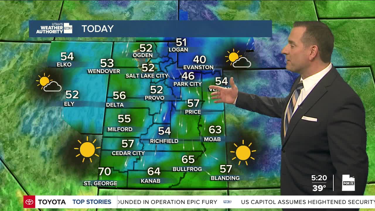
Tuesday: Morning showers ending, then partly cloudy in the afternoon. Highs: Low 50s.
Tuesday Night: Mostly clear. Lows: Upper 30s.
ST. GEORGE
Tuesday: Sunny & mild. Highs: Near 70.
Tuesday Night: Mostly clear. Lows: Lower 40s.
