
After a stretch of early summer heat, northern Utah is getting a bit of a breather today. Temperatures across the Wasatch Front will cool closer to seasonal averages, with highs landing near where we’d typically expect for early June.
A few scattered showers are also possible through the day, mainly across northern Utah and higher terrain areas. Don’t expect a washout...more of a 'just enough to ruin the carwash" kind of setup.

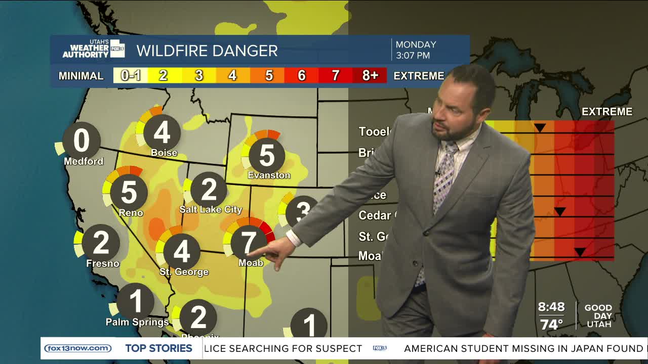
Meanwhile, Red Flag Warnings continue for central and southern Utah through this evening as gusty winds, dry air, and critically dry fuels keep fire danger elevated. Any new fire starts could spread quickly under these conditions.

Unfortunately, the fire weather pattern isn’t going anywhere fast. Breezy southwest winds are expected to persist into midweek across central and southern Utah, keeping wildfire concerns high even as northern Utah enjoys slightly cooler conditions.
It’s classic Utah June: a little spring hanging on up north while southern Utah starts auditioning for July.
