
It's a hazy start to your Saturday with wildfire smoke blanketing much of northern Utah. South flow in place this morning is bringing up smoke from new fires burning in Central and Southern Utah.

A weak cold front moving through northern Utah this afternoon should improve air quality up north but keep smoke impacts over southern Utah into Sunday.
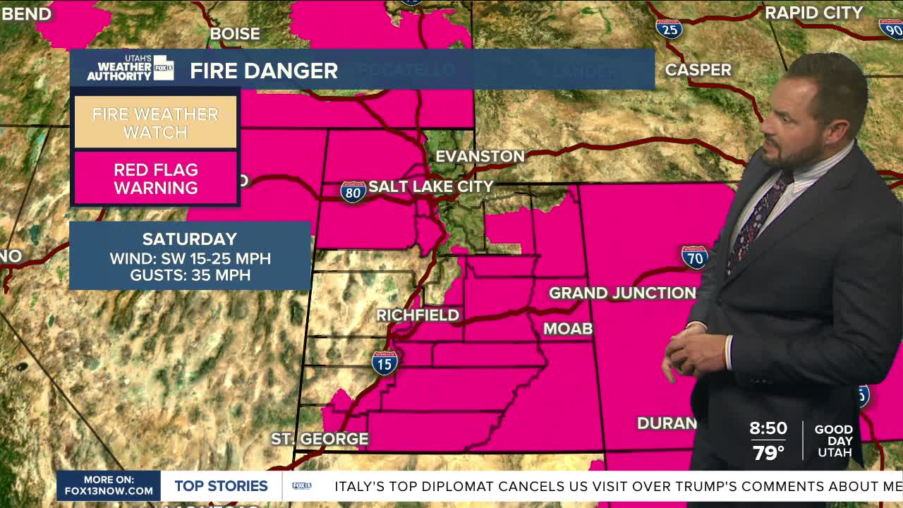
On top of that, critical fire weather conditions continue across parts of central and southern Utah today as gusty winds and very low humidity combine to create dangerous wildfire conditions.

Northern Utah could see a few showers and thunderstorms, mainly near the Idaho border as the cold front moves through. Most storms will produce little rainfall, but strong wind gusts and dry lightning remain possible.
Behind the front, a brief cooldown arrives through Sunday, but high pressure will rebuild early next week, bringing hotter temperatures and continued dry conditions. By midweek, some valleys, including the Wasatch Front, could see an increased risk of heat-related illness as temperatures climb close to the century mark.
