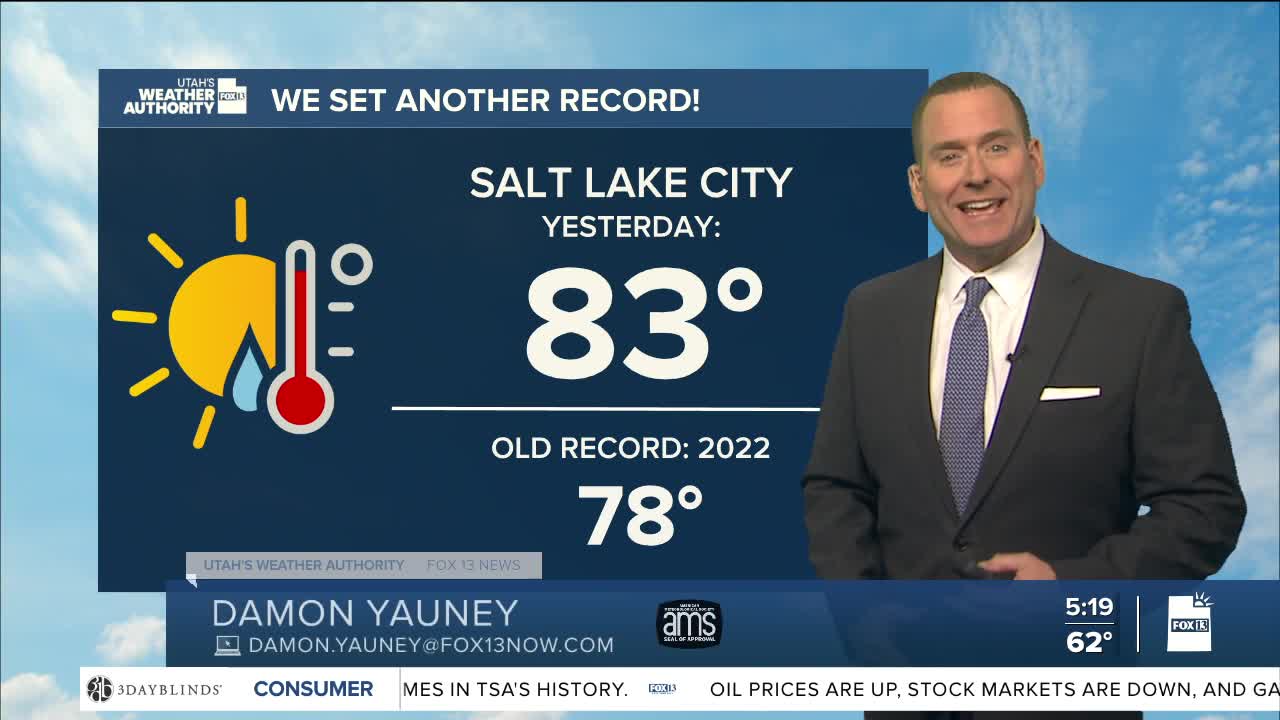


After several days of record to near-record heat, it's going to feel more like you'd expect it to for late March!
Cooler air spilling in behind a dry cold front will keep it about 15-20 degrees lower than yesterday across northern & central Utah. The front will fall apart as it moves south with temperatures only dropping a few degrees lower in southern Utah. But it was so warm ahead of the front that it's still going to be well above average today!
Near record warmth is expected again this weekend before a change in the weather pattern ushers in colder, wet weather next week.
SALT LAKE CITY
Thursday: Sunny & much cooler. NW winds 10-20 mph. Highs: Mid 60s.
Thursday Night: Partly cloudy & colder. Lows: Upper 30s.
ST. GEORGE
Thursday: Sunny. Highs: Near 90.
Thursday Night: Mostly clear. Lows: Mid 50s.
