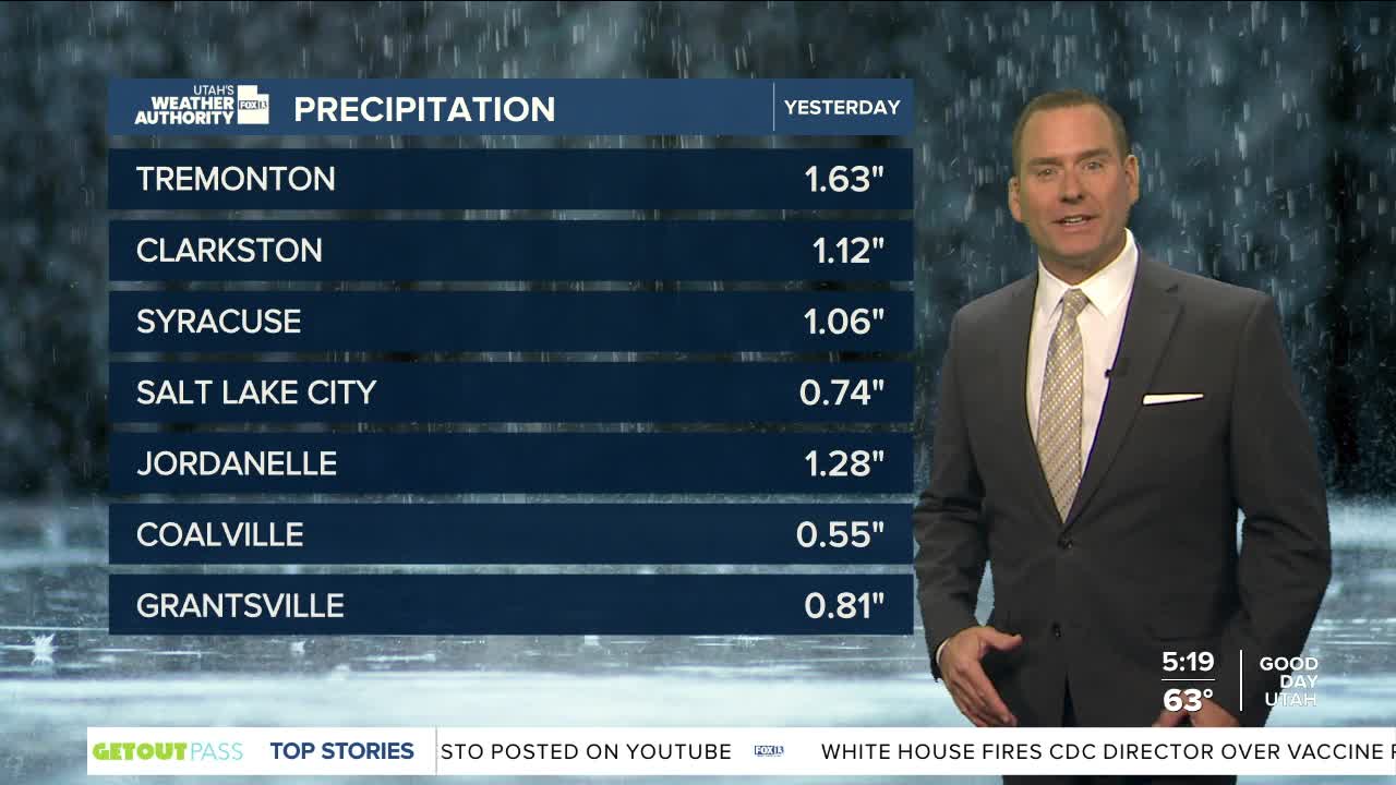


We're not out of the woods yet, but it won't be as stormy as it was yesterday.
A warming & drying trend is expected the next few days. As moisture decreases, so will the showers & t-storms. Heavy rain is possible out of any storms that pop up, but even so the overall flash flood threat is lower than it was yesterday.
A brief surge of moisture could bring more light to moderate showers across the south tonight and early tomorrow, but it won't stick around long.
Sunny & warmer weather is still on tap for the weekend with Labor Day temps climbing near 100 in St. George and near 90 along the Wasatch Front.
SALT LAKE CITY
Thursday: Partly cloudy with a few morning showers, then a 30% chance of showers & t-storms in the afternoon. Patchy smoke possible. Highs: Near 80.
Thursday Night: Mostly cloudy with patchy smoke. Lows: Mid 60s.
ST. GEORGE
Thursday: Partly cloudy. Highs: Mid 90s.
Thursday Night: Cloudy with a slight chance of showers & t-storms. Lows: Lower 70s.
