

After a stretch of hot & dry summer weather, a cool & wet pattern is setting up!
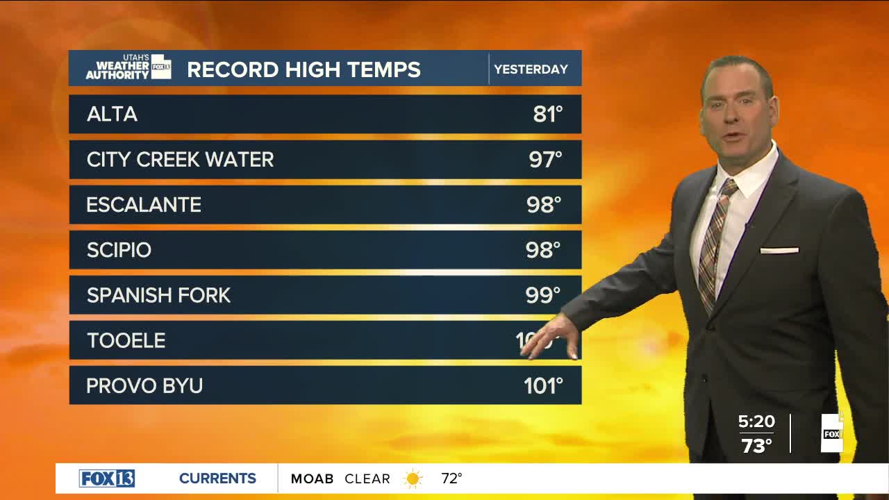
It's going to be hot again today with an Extreme Heat Warning in effect for lower Washington County from noon today through 9 pm Friday. Temps across the rest of the area will still climb well above average, but not as high as earlier this week.
With monsoonal moisture increasing, showers & t-storms will become more likely heading into the weekend. At first, storms will mainly be dry with gusty winds. But over the next few days, wetting rains will become more likely.
With heavy rain possible by the end of the weekend, the flash flood threat will rise & temps will drop!
SALT LAKE CITY
Thursday: Partly cloudy with isolated, mainly dry thunderstorms possible in the afternoon. Highs: Mid 90s.
Thursday Night: Partly cloudy. Lows: Lower 70s.
ST. GEORGE
Thursday: Extremely hot! Becoming partly cloudy with a slight chance of showers & t-storms in the afternoon & evening. Highs: Near 108.
Thursday Night: Mostly clear & warm. Lows: Near 80.
