

Spring is officially here, but it's going to feel like summer for most of the week!
Even though it's going to be mostly cloudy today, temperatures will still climb well above average for late March. And with another strong ridge of high pressure building over Utah, it's going to stay dry and continue to warm up.
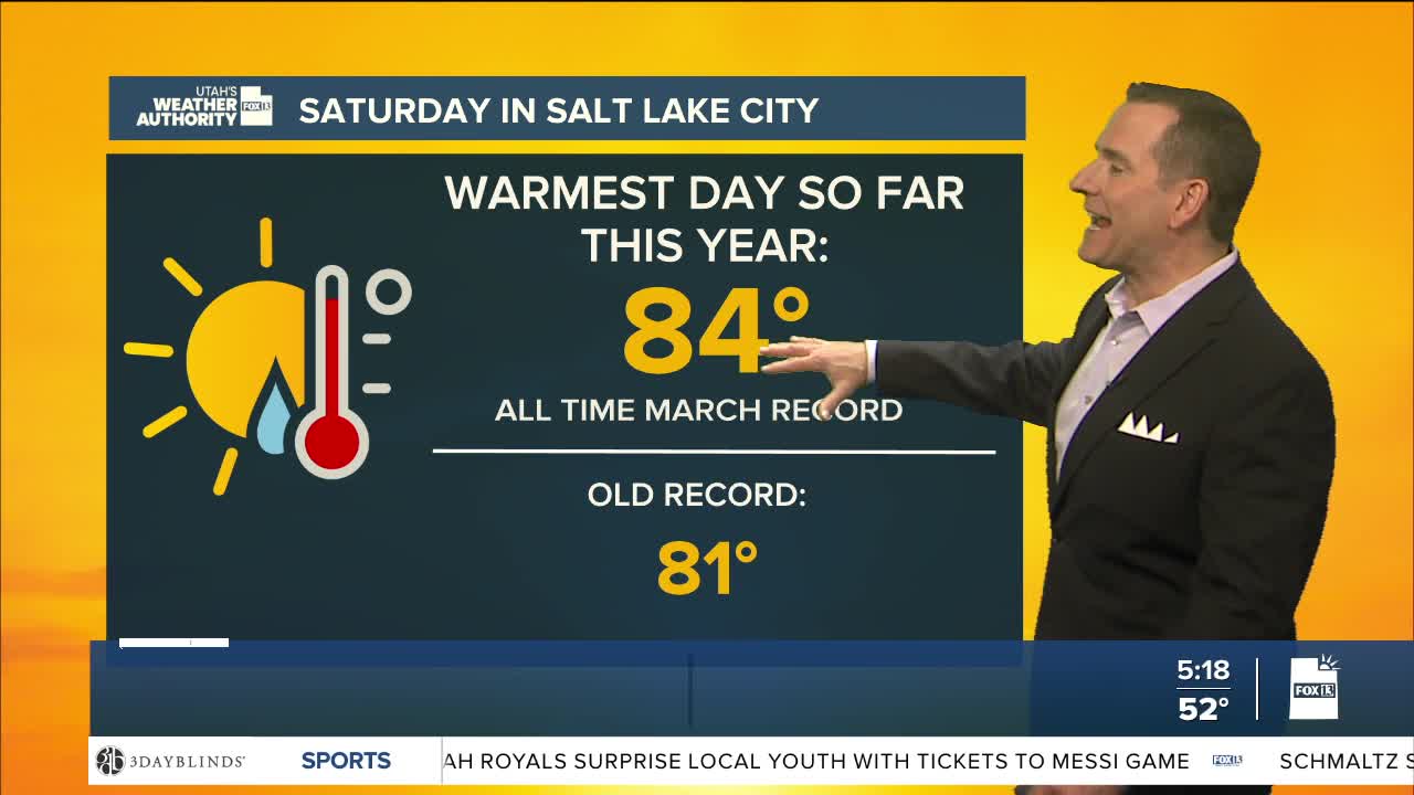
In fact, temps will likely make it back into record territory along the Wasatch Front tomorrow and could climb into the mid 80s again by Wednesday. If it hits 84 F in Salt Lake City, that would tie the all-time record high temp for the month of March that we hit on Saturday.
Another cold front will bring slightly cooler temps to the north on Thursday & Friday, while little change is expected this week across the south.
The dry spell will continue with the next chance of precipitation not looking likely until the very end of March into the first couple days of April.
SALT LAKE CITY
Monday: Mostly cloudy & mild. Highs: Low 70s.
Monday Night: Becoming partly cloudy. Lows: Lower 50s.
ST. GEORGE
Monday: Sunny. Highs: Near 90.
Monday Night: Mostly clear. Lows: Near 60.
