Weather

Actions

Warm and windy weekend

Saturday Morning Weekend Forecast
Posted

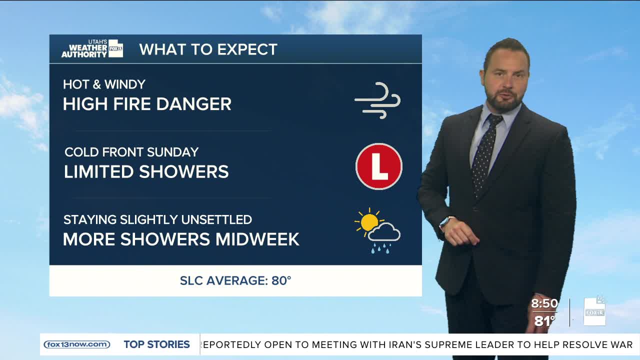
It's a warm and windy start to the weekend with temperatures already in the low 80s this morning along portions of the Wasatch Front. Temperatures will stay 10 to 15 degrees above normal this afternoon as gusty southwest winds are in place across central and southern Utah.

Graphics from the FOX 13 Weather Center showing the hourly forecast for the Wasatch Front. Starting at 10AM with a temperature of 84°, rising up to 94° by 4 PM, before dropping down to 75° by 2 AM Sunday morning.
Graphics from the FOX 13 Weather Center showing the hourly forecast for Southern Utah. Starting at 10 AM at 87°, rising up to 99° with wind by 4 PM, before dropping down to 80° by 2 AM Sunday morning.

Combined with very dry air, those winds will create widespread critical fire weather conditions that could last into next week. Red Flag Warnings are in place through Sunday evening for low relative humidity, wind gusts to 40 mph, and hot temperatures.

Graphics from the FOX 13 Weather Center showing the areas of Utah under Red Flag warnings. Much of central and southern Utah are flagged for possible fire danger, with the warning in place until 10 PM Sunday.

Northern Utah could also see a few high-based showers or thunderstorms Saturday late afternoon. While little rain is expected, storms may still produce strong outflow winds, isolated lightning strikes, and blowing dust.

Graphics from the FOX 13 Weather Center showing the predicted wind speeds. From top to bottom, left to right: Elko 32 miles-per-hour, Ogden 25 miles-per-hour, Logan 23 miles-per-hour, Evanston 35 miles-per-hour, Rock Springs 32 miles-per-hour, Wendover 26 miles-per-hour, Salt Lake 31 miles-per-hour, Vernal 27 miles-per-hour, Ely 31 miles-per-hour, Delta 34 miles-per-hour, Provo 28 miles-per-hour, Price 26 miles-per-hour, Grand Junction 24 miles-per-hour, Milford 41 miles-per-hour, Bryce Canyon 34 miles-per-hour, Moab 32 miles-per-hour, Cedar City 37 miles-per-hour, St. George 30 miles-per-hour, Blanding 25 miles-per-hour, Page 20 miles-per-hour

A mostly dry cold front will move through northern Utah late tonight into Sunday, bringing slightly cooler temperatures. However, breezy and dry conditions will continue to keep fire danger elevated statewide.

Another storm system could bring cooler weather and a better chance for showers by the middle of next week.

REAL-TIME WEATHER: Get the latest weather forecasts by downloading the FREE Utah Weather Authority app