
We're off to a calm start this Saturday morning; however, we're in for a major weather swing this weekend!
We start with critical fire danger in the south today, followed by an unusually cold storm system bringing mountain snow and freezing temperatures statewide early next week.

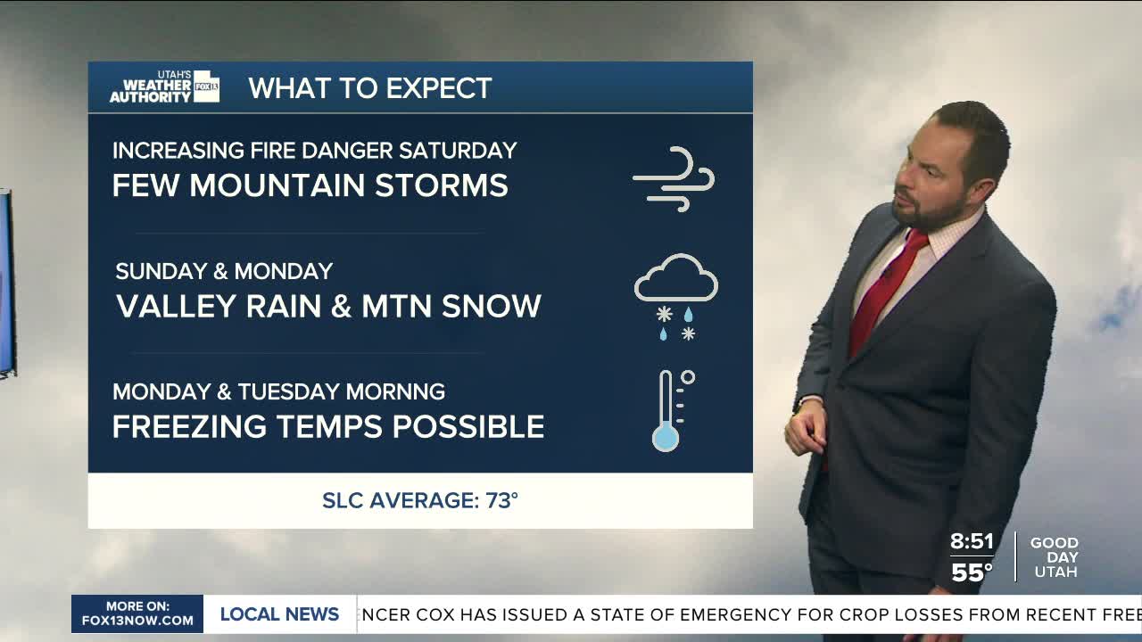
Here's what you can expect: Saturday and Sunday will feature warm, dry, and windy conditions across southern Utah, creating critical fire weather conditions near the Arizona border.
A strong cold front will then move through the state on Sunday, dropping temperatures 10 to 20 degrees below normal by Monday. Northern Utah valleys may struggle to reach 60 degrees Sunday, with even colder conditions arriving Monday.

The storm will bring widespread rain and accumulating mountain snow, especially across northern Utah, the Uintas, and southwest Wyoming. Snow levels could fall to around 5,000 to 6,000 feet by early Monday.

Freeze conditions are also possible Monday and Tuesday mornings in valleys outside the Wasatch Front, including Cache Valley, the Wasatch Back, Sanpete Valley, southwest Utah, and parts of west-central Utah.
A gradual warming trend is expected later next week.
