


SALT LAKE CITY — It's one storm down and one more to go for northern Utah as another system heads into the area overnight Wednesday.
LIVE RADAR: Track the storm as it approaches your neighborhood with FOX 13s interactive radar
The new storm will likely be weaker than the one that dumped massive amounts snow along the Wasatch Front on Tuesday night, causing disruptions to school schedules and morning commutes.
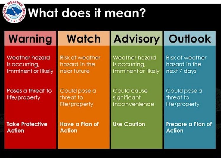
A Winter Weather Advisory has been issued for the Salt Lake area and further north until 8 a.m. Friday. Unlike Tuesday's storm warning, an advisory means hazardous weather is imminent, and "could cause significant inconvenience."
A new round of snow will hit the northern parts of the state in the early morning hours, beginning around 1 a.m.
DOWNLOAD FOR FREE: Stay updated on the latest condition with the free FOX 13 Weather app
While most of the snow is expected north of Salt Lake City, areas in the valleys should still expect to see up to 4 inches of new snow, while the mountain areas could find an additional 14 inches.
Slick road conditions will be possible due to the snowfall and freezing cold temperatures.
