


SALT LAKE CITY — As Utah welcomes with its first significant snowstorm of the season, residents can expect to see increasing chances of more snow through Friday afternoon.
LIVE RADAR: Follow the snowstorm in your neighborhood with FOX 13s interactive radar
While poor weather conditions have contributed to a number of vehicle accidents across the state, those incidents are expected to increase due to snow building up on roadways. Currently, the warm surface temperatures have stopped the snow from accumulating, but that is expected to change in the evening.
FOX 13s Dani Ruberti has the latest on what Utah can expect during the remainder of the storm
The storm will have a much bigger impact on the Thursday afternoon commute and drivers are urged to practice caution.
DOWNLOAD FREE - Get updated information on the FREE FOX 13 weather app
Snowfall will taper off into Thursday evening before conditions deteriorate Friday morning as the temperatures dive and snow returns during the morning commute. The cold temperatures will create icy conditions on the roads, allowing the snow to stick.

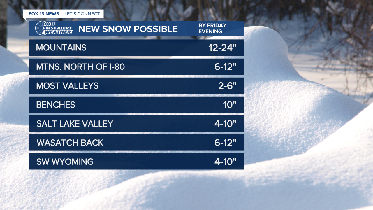
Lake effect snow is possible Friday, with the chance heavy of snow bands developing on the benches in Salt Lake and Davis counties.
Thursday's storm brought Salt Lake City its first measurable snowfall in 259 days, the city's fourth longest streak with no snow. It's also the fifth latest snow of the winter season in the city's history.
Despite the accidents, the storm was welcomed with open arms by the state's ski resorts who have had to delay opening for the season. As of 2:45 p.m., the Snowbird ski resort had reported 10 inches of snowfall in the last 24 hours, while video showed parking lots packed with skiers and snowboarders at Brighton and Solitude resorts.
