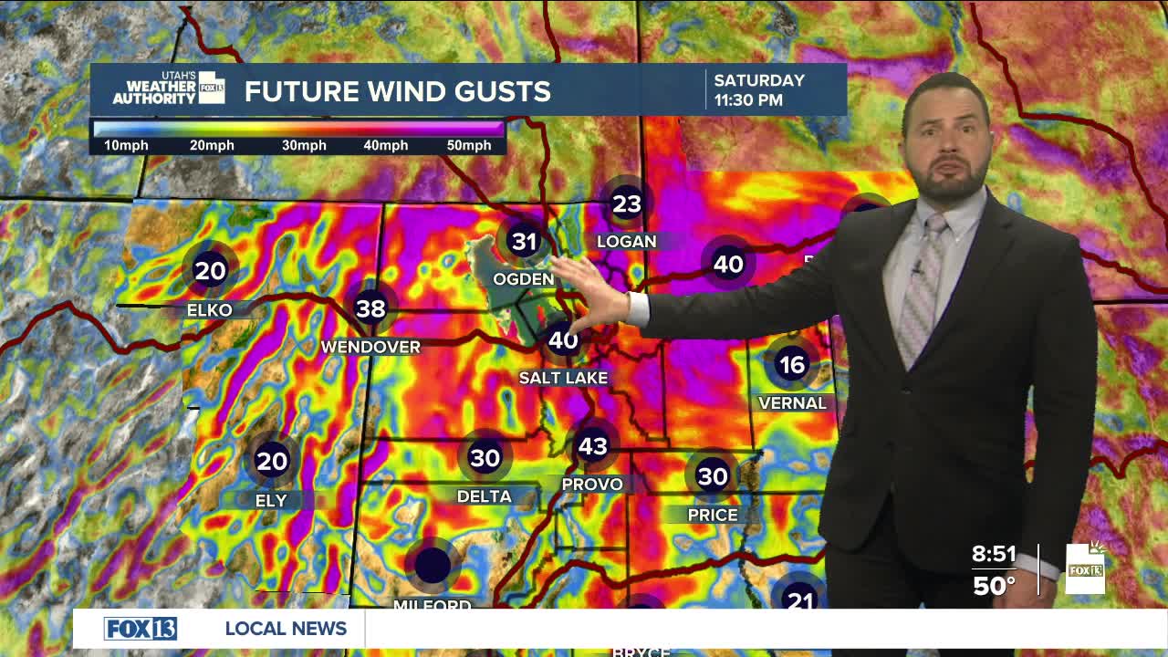

We're going to see a quick round of active weather Saturday before a dramatic warmup settles in for much of next week. A cold front moving through northern Utah Saturday afternoon and evening will bring strong west winds and a slight chance for thunderstorms. The front is expected to move through northern Utah late afternoon and reach central Utah by early evening.

Behind the front, wind gusts of 50 to 65 mph will be possible across parts of northern and central Utah. High Wind Warnings are in effect for areas including the Great Salt Lake Desert, western Uinta Mountains, the Uinta Basin, Castle Country, the Book Cliffs, the Wasatch Plateau and parts of central Utah.
Along the Wasatch Front, gusts around 50 to 55 mph are possible, though isolated stronger winds could develop if showers or thunderstorms form along the front. A High Wind Watch is also in effect for lower Washington County late Saturday night into early Sunday for potential gap winds.

After the winds ease Sunday morning, a major shift in the weather pattern is expected. An unusually strong high-pressure system will build across the West next week, sending temperatures soaring 20 to 30 degrees above normal by the latter half of the week. By Thursday and into next weekend, temperatures in parts of Utah could challenge all-time March records.
In southern Utah, it may feel more like May than mid-March. Daytime highs are expected to soar into the mid to upper 90s by Friday, stay tuned.
