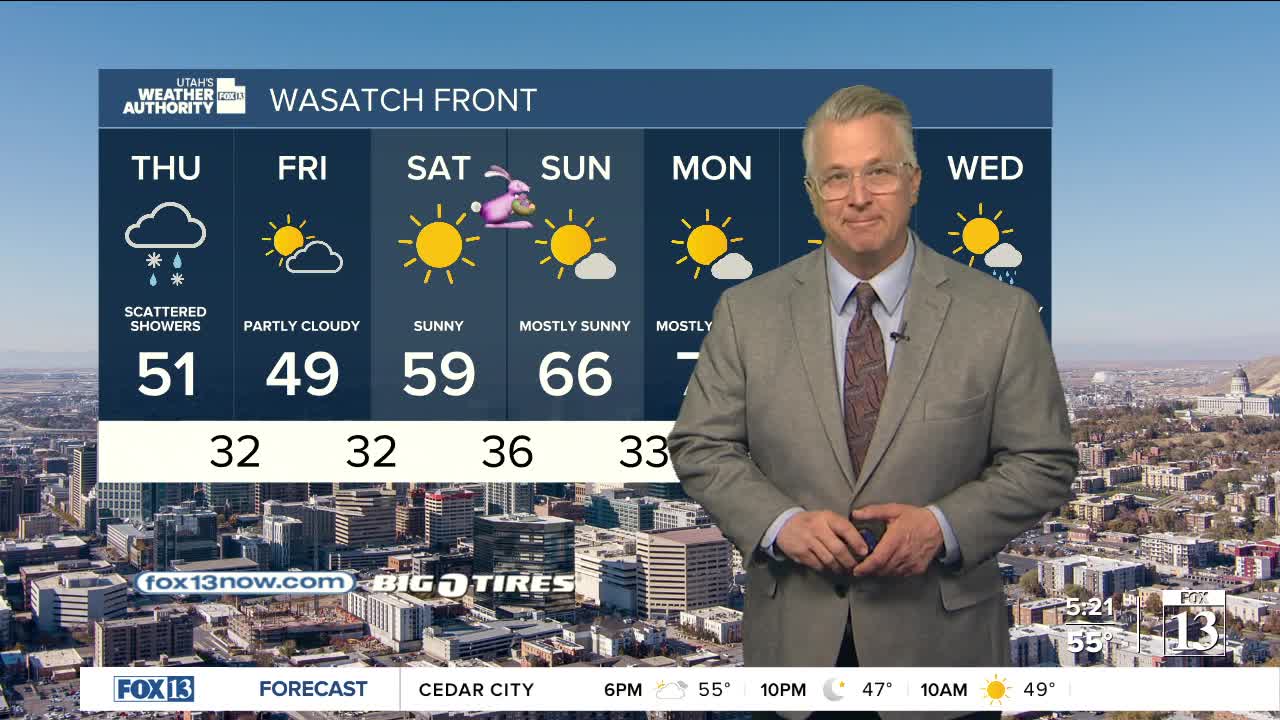


March didn't exactly go out like a lion, but it did roar a little last night as some rain & snow finally made it's way back in!
April is off to a soggy start with widespread valley rain & high elevation mountain snow. Most snow will be above 7,500 ft. in the northern mountains and above 8,500 ft. in the south. Rain showers & isolated t-storms are most likely in the morning. They might not wind down entirely, but will decrease in the afternoon & evening.
We'll get a little bit of a break tonight before an even stronger and colder storm moves in tomorrow. A cold front will drop south across the area tomorrow with gusty winds out ahead of and behind it.
Valley rain & mountain snow will be most likely across northern & central Utah. It's going to be cold enough that snow could mix with rain in the valleys by afternoon & evening. Accumulations are possible down to the valley floors by Friday morning. But that'll be on the tail end of the storms, so amounts would likely very light.
Temps could be near freezing in the valleys on Friday & Saturday mornings, but luckily it'll become sunny and warm up nicely over Easter weekend!
SALT LAKE CITY
Wednesday: Showery & cooler with a slight chance of thunderstorms. Highs: Near 60.
Wednesday Night: Mostly cloudy & colder with decreasing showers. Lows: Lower 40s.
ST. GEORGE
Wednesday: Becoming partly cloudy with a chance of rain showers in the afternoon. Highs: Near 70.
Wednesday Night: Mostly clear & cooler. Lows: Mid 40s.
