



Happy Halloween, Utah!
We're seeing a brief break from the widespread rain Saturday before a much stronger storm moves in Sunday. Mostly cloudy skies are expected today with spotty showers, mainly over the higher terrain. Trick-or-treaters should see mainly cloud cover this evening over northern Utah while rain will increase over southwest Utah.
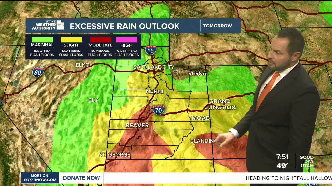
An atmospheric river will bring widespread rain and mountain snow to Utah Sunday into Monday, with periods of heavy rain possible. The heaviest rainfall will increase the risk of flash flooding, particularly across southern and eastern Utah. A Flood Watch remains in effect for those areas through Monday.
A strong cold front will also drop snow levels from around 9,000 feet to as low as 6,500–7,000 feet Sunday night into Monday. Heavy mountain snowfall is expected above 8,000 feet, especially across locations favored by northwest flow. Most mountain areas will see 6-12" with locally higher amounts in the Upper Cottonwoods and the Uintas.
The storm moves out Monday, leaving behind much cooler temperatures. Highs will run about 10–15 degrees below normal before drier weather returns Tuesday. Another round of unsettled weather is possible later next week.