

Grab a good coat before you head out the door! Temps were mild this morning ahead of a cold front that will cross the Wasatch Front during the middle of the day, then slide into Southern Utah by later this evening. Temps will drop dramatically behind the front!
Winds will be gusty out ahead of and behind the front. Some of the stronger winds will be through the canyons of Eastern Utah and Lower Washington County later tonight into tomorrow morning.
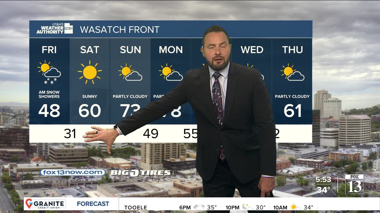
The storm will be a fast-mover and that will limit the amount of snow we might get. 3-6 inches are likely in the Northern Mountains, T-2 inches on the Wasatch Back & benches, and less than an inch in the Northern Valleys. A "wild card" could be if any lake effect snow develops on Friday morning.
Temps behind the front will go into a free-fall! With the exception of the far southern valleys, it's going to drop below freezing tonight into Friday morning, and then again Friday night/Saturday morning. Protect any plants & exposed sprinkler systems (you might want to drain them again)!
Spring bounces back this weekend with sunny, warmer weather!
SALT LAKE CITY
Thursday: After a warm start, temps will hover near 40 in the afternoon. Otherwise, mostly cloudy with a chance of rain showers in the morning, then changing to snow this afternoon. Minor accumulations possible.
Thursday Night: Mostly cloudy & much colder with a chance of snow showers. Lows: Upper 20s.
ST. GEORGE
Thursday: Becoming partly cloudy & breezy. SW winds 15-25 mph. Highs around 80.
Thursday Night: Partly cloudy. NE winds 10-20 mph, but much stronger near the canyons. Lows: Lower 40s.
