

Dry, breezy conditions will keep fire danger elevated again today, especially across Southern & Eastern UT. Another red flag warning will be in effect this afternoon in SE Utah.
Moisture moving in from the southwest will bring a slight chance of isolated high-based showers & t-storms to Northern Utah. Those could also bring gusty winds this afternoon & evening.
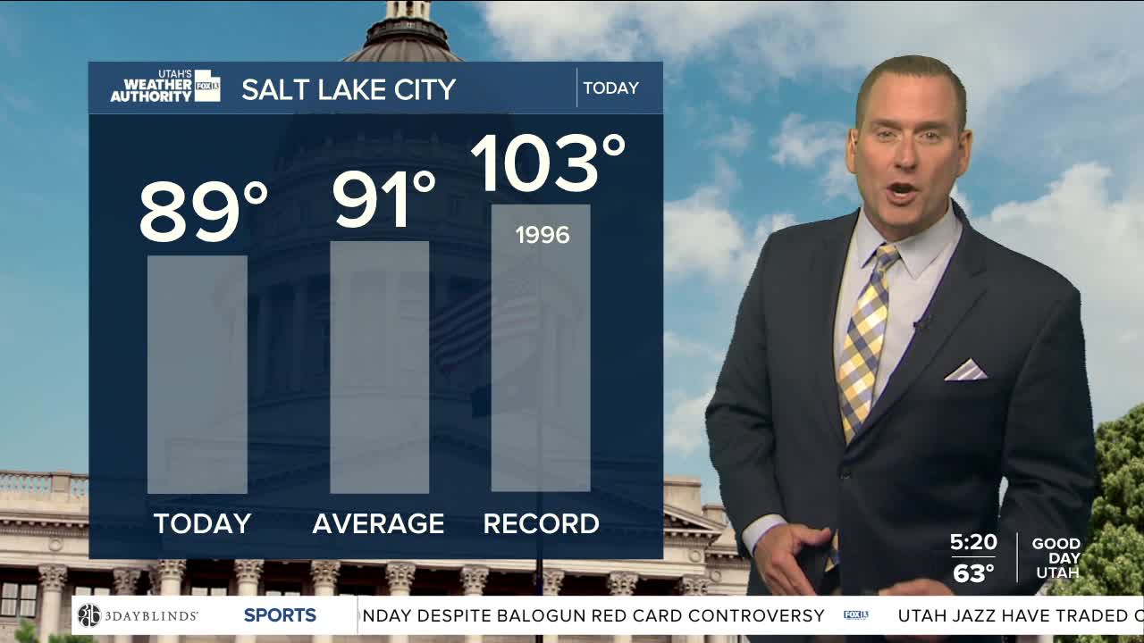
Winds decrease this holiday weekend, but it's going to be hot & dry! Temps are expected to climb into the mid to upper 90s along the Wasatch Front and well above 100 in Lower Washington County.
SALT LAKE CITY
Thursday: Partly cloudy. Highs: Upper 80s.
Thursday Night: Partly cloudy & mild. Lows: Lower 60s.
ST. GEORGE
Thursday: Sunny. Highs: Mid 90s.
Thursday Night: Clear. Lows: Upper 60s.
