


ST. GEORGE, Utah — Dangerous flooding remains a major concern across most of southern, central, and eastern Utah as storms generated from remnants of once Hurricane Priscilla move into the state.
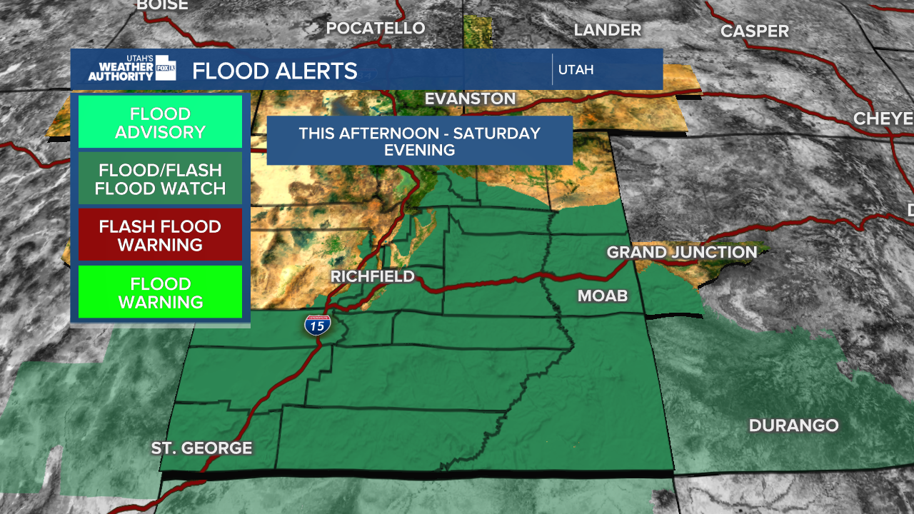
Flood Warnings are in effect for several counties.
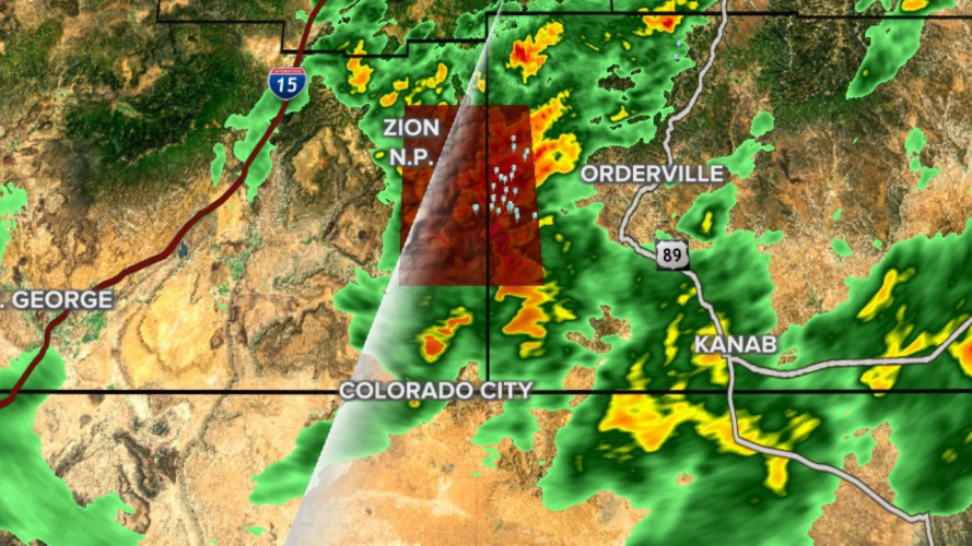
The towns of Springdale and Rockville are also being warned to take precautionary actions should flooding occur.

Beaver, Carbon, Daggett, Duchesne, Garfield, Grand, Iron, San Juan, Sanpete, and Uintah also have flood watches in effect through Sunday. Find the latest on the warnings here.
Initial moisture began moving into Utah late Thursday, with most areas under at least Flood Watch conditions through Saturday, although some watches extend into Sunday.
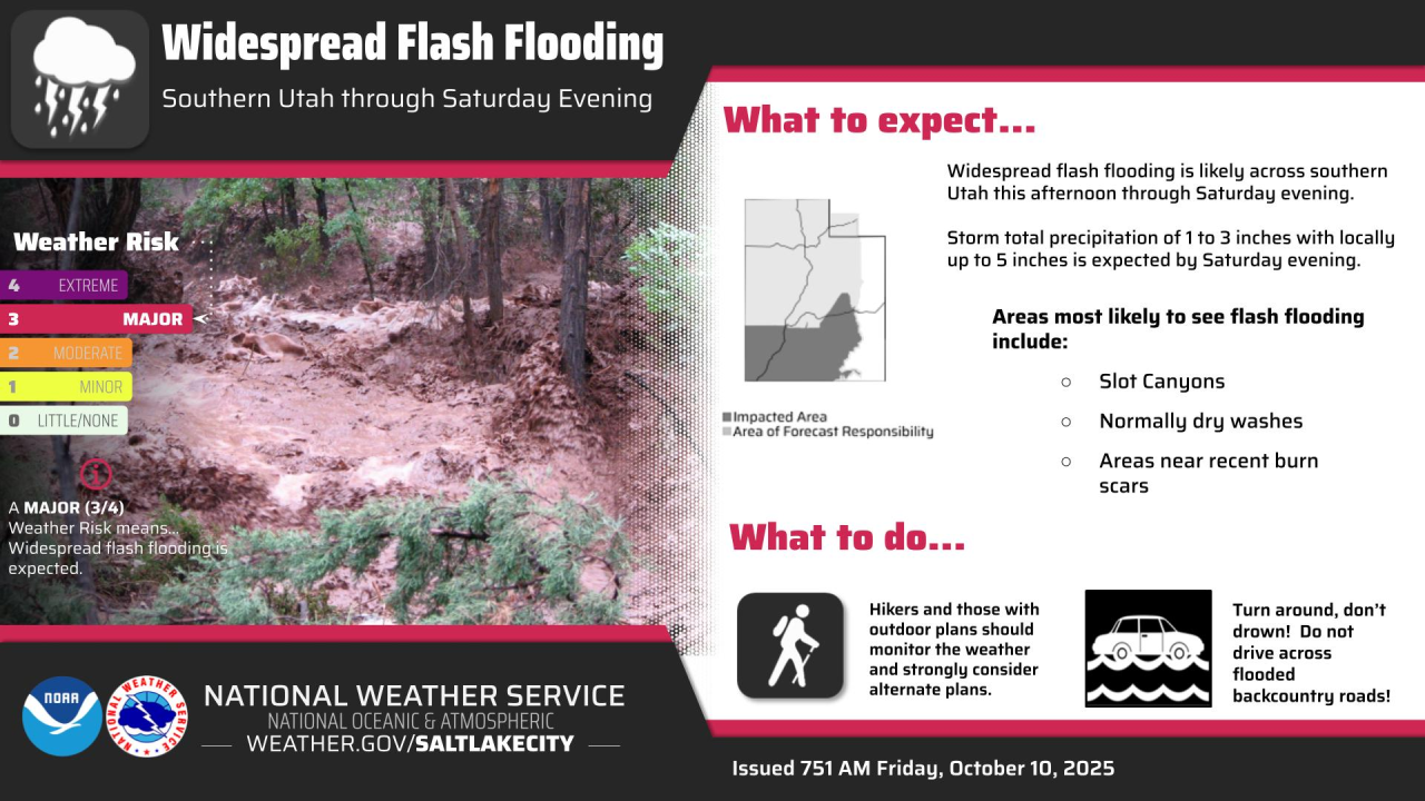
Officials are warning residents and visitors in the affected areas to be aware of the possibility of flash flooding, especially in Utah's "Mighty 5" national parks, which are currently dealing with an influx of visitors due to the state's fall break, as well as lessened support because of the ongoing government shutdown.
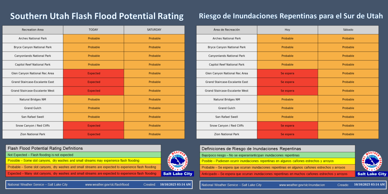
The National Weather Service issued an outlook showing "probable" flash flood potential for nearly all of southern Utah starting Thursday.
Concerns of flooding are increased in areas near burn scars left behind from this summer's wildfires. Over 15,000 acres were burned by the Forsyth Fire in Pine Valley, leaving the area vulnerable to flash flooding, in which a major downpour could send torrents of water, mud, and debris through the valley.
Rains may wreak havoc on burn areas left after Forsyth Fire in southern Utah:
Along with recent burn scars, the highest risk for flooding will be in areas like slot canyons, normally dry washes, and slickrock areas, according to the National Weather Service.
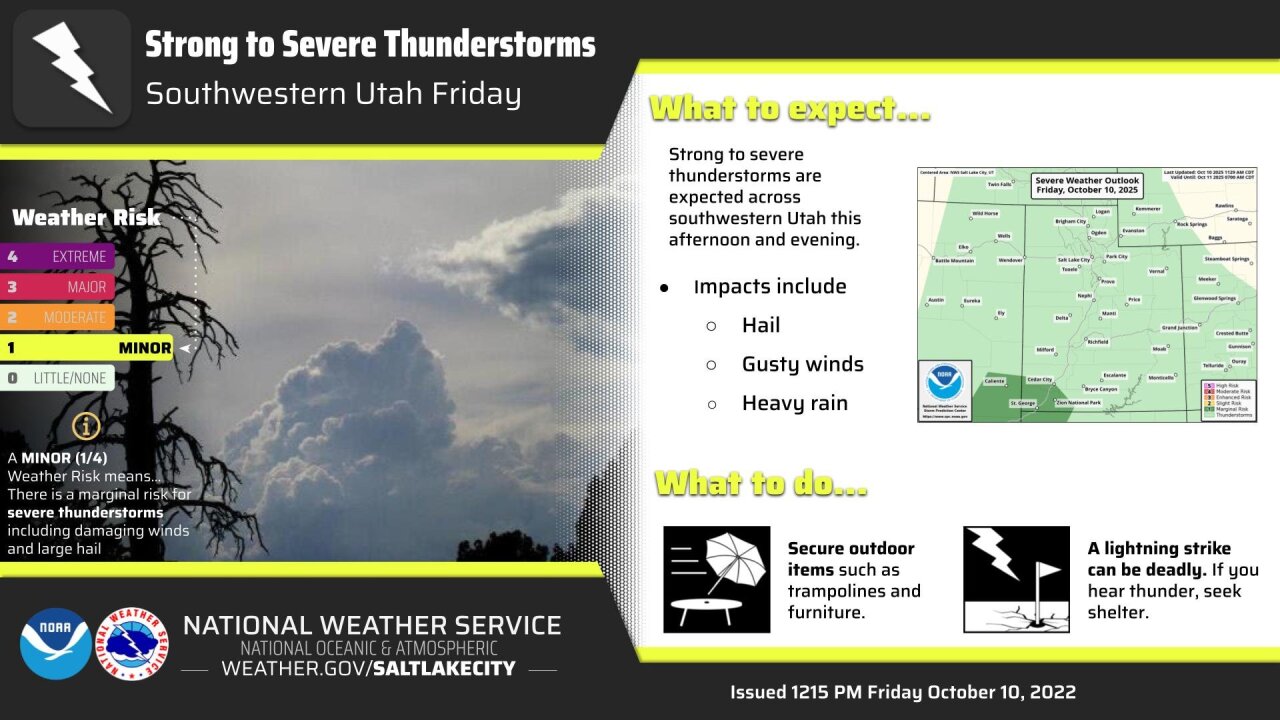
Forecasters are also warning southwestern Utah of potential for strong to severe thunderstorms throughout the afternoon and into the evening. The highest threats will be strong winds, small hail, and very, very heavy rain.
Storms are expected to develop after 2:00 p.m. and continue through at least 9:00 p.m.
No flood watches or warnings have been issued for northern Utah, but a strong cold front forecast for Saturday evening, could bring severe storms along the Wasatch Front and other locations around the state.
