

It’s been a cooler start to Sunday in northern Utah, with morning temperatures running about 10 degrees below normal. Highs this afternoon will warm into the mid to upper 80s up north, while southern Utah bakes under typical triple-digit heat. Expect mostly sunny skies statewide and lighter winds through the day.
High pressure builds in as we start the work week, bringing hotter and drier conditions. Along the Wasatch Front, highs will climb toward 100° by Wednesday, while St. George will push near 109°. By late week, models suggest a shift as monsoon moisture begins to creep back into the state. Scattered thunderstorms could develop Thursday and linger into the weekend. With the added moisture, temperatures will ease back a bit heading into the weekend.
SALT LAKE CITY
Sunday: Mostly Sunny. Highs: Mid-upper 80s.
Sunday Night: Mostly Clear. Lows: Near 62.
Monday: Mostly Sunny. Highs: Near 92.
Tuesday: Mostly Sunny. Highs: Near 96.

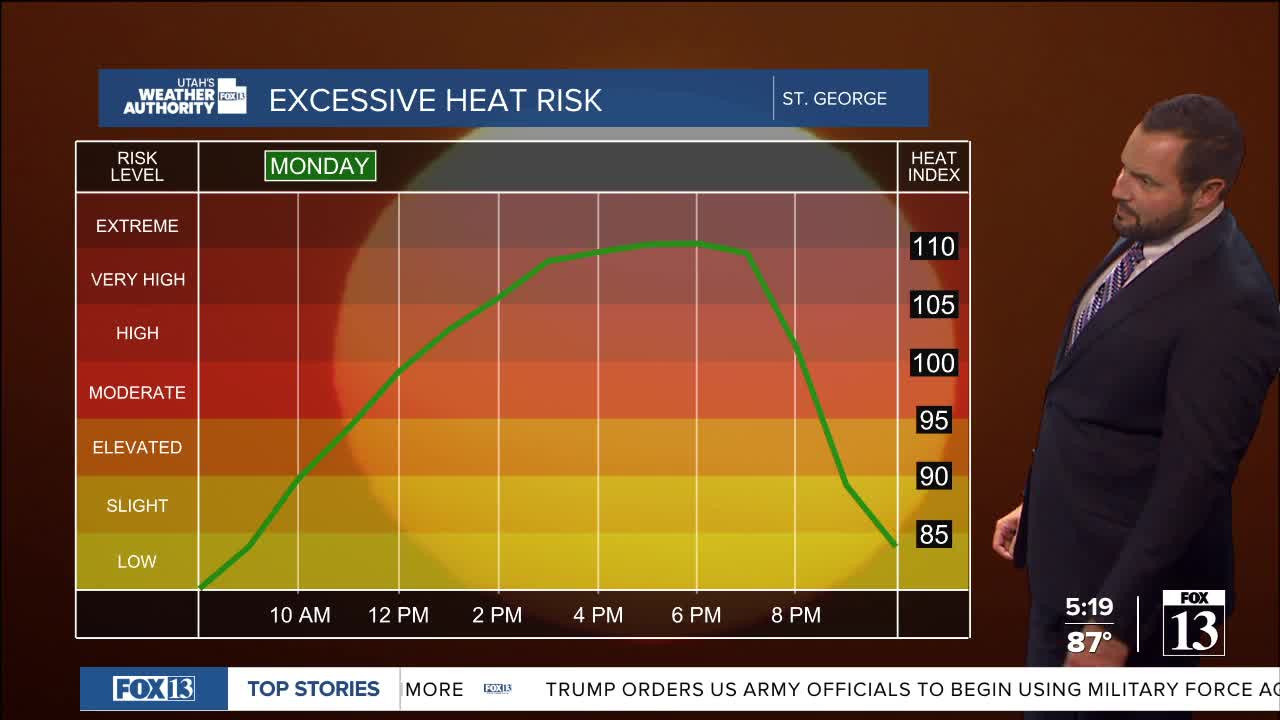
ST. GEORGE
Sunday: Very Hot and Breezy. High: Near 106.
Sunday Night: Mostly Clear. Lows: Near 73.
Monday: Very Hot and Sunny. High: Near 108.
Tuesday: Very hot and Sunny. High: Near 109.

