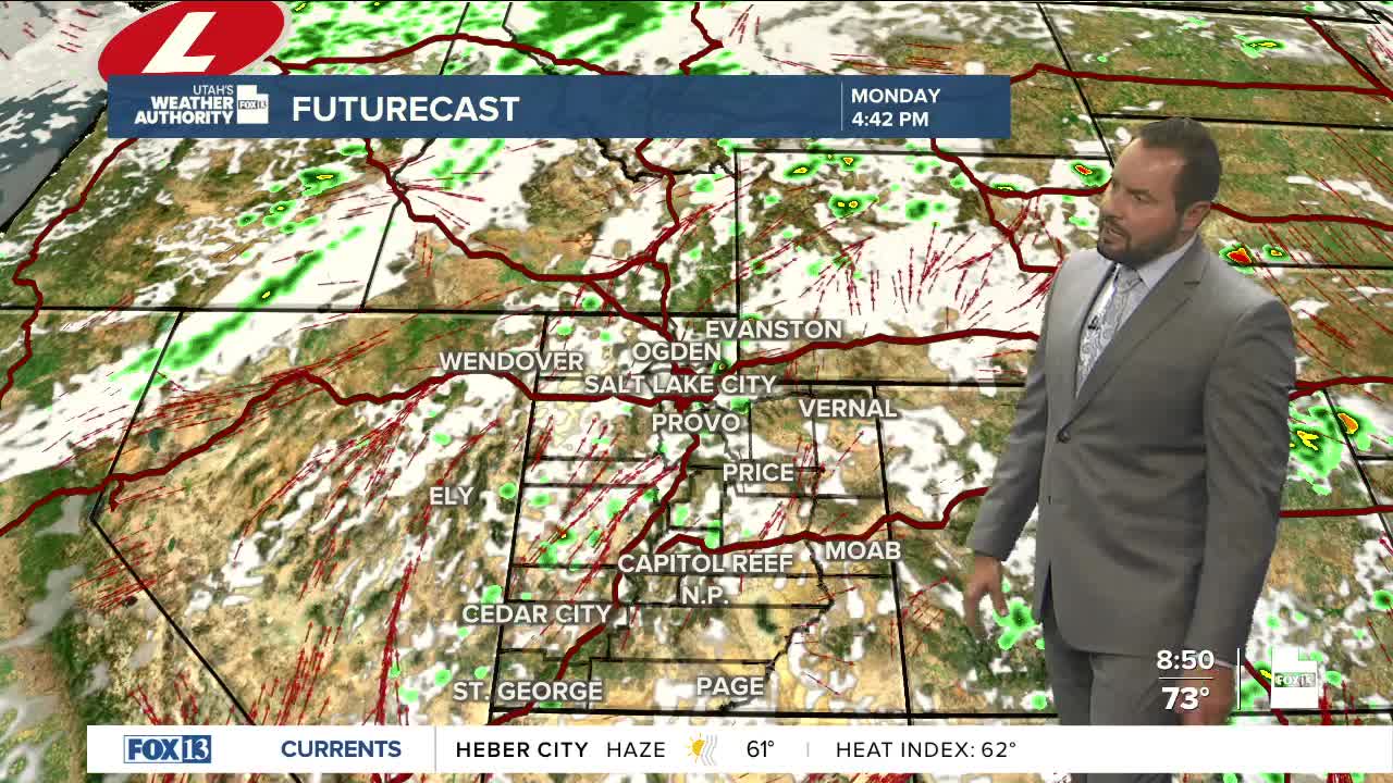

A mix of sun and clouds for much of the state Saturday as some moisture remains. Southwest flow will continue today, maintaining a risk of isolated thunderstorms, generally over the higher terrain.
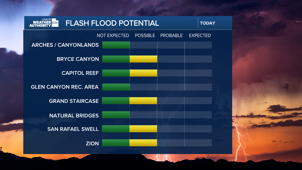
Flash flood potential also remains over some of our national parks and recreational areas, Zion, Bryce Canyon, Capitol Reef, Grand Staircase-Escalante, and San Rafael Swell. Thunderstorms will flare up this afternoon and will be capable of producing moderate to heavy rainfall. Make sure to check with the local ranger station before you head out.
By Sunday, drier air will be moving in, and most areas will remain hot and dry. Daytime highs are climbing slightly above normal up north, with near-average heat in southern Utah. An approaching storm in the Pacific Northwest will increase winds over the state into the work week.
This will elevate fire weather conditions over southern Utah, where winds will be gusty, up to 25 mph. The storm will clip northern Utah late Monday into Tuesday, helping drop temperatures a few degrees statewide. However, little to no moisture is expected from the passing storm.

SALT LAKE CITY
Saturday: Partly cloudy, slight chance of storms. Highs: Mid 90s.
Saturday Night: Mostly clear. Lows: Near 70.
Sunday: Mostly Sunny and Breezy. Highs: Upper 90s.
Monday: Mostly Sunny and Windy. Highs: Mid-90s.
ST. GEORGE
Saturday: Mostly Sunny & Hot. Highs: Near 101.
Saturday Night: Mostly clear. Lows: Mid-70s.
Sunday: Sunny & Hot. Highs: Near 102.
Monday: Mostly Sunny and Not as Hot. Highs: Near 98.
