

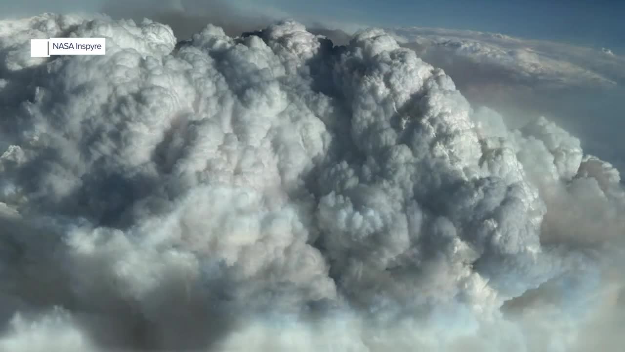


SALT LAKE CITY — When a wildfire gets big and hot enough, it can actually create its own thunderstorm — a phenomenon called a pyrocumulonimbus, or pyroCb.
These fire-generated storms can dramatically intensify fire behavior while sending huge amounts of smoke high into the atmosphere.
Now, NASA and researchers from across the country are studying these extreme storms to better understand how they form, how they affect wildfires and what happens to the smoke once it reaches the upper atmosphere.
When fire creates its own weather
Over an intense wildfire, enormous amounts of heat cause air to rapidly rise. As that air rises, it cools and eventually condenses, creating a towering cloud.
If the updraft becomes strong enough, that cloud can develop into a thunderstorm — a pyrocumulonimbus.
These storms can create dangerous conditions around the fire, including erratic winds, lightning and even fire-generated tornadoes.
“They can affect the situation near the ground in terms of erratic wind behavior, fire-generated tornadoes, even lightning strikes,” said Dr. Dave Peterson, a meteorologist with the Naval Research Laboratory. “So there's an immediate hazard near the fire that has an impact on the public response and the firefighting effort.”
But the impacts don't stop at the fire line.
A chimney into the atmosphere
A pyroCb can act like a giant chimney, carrying enormous amounts of wildfire smoke high into the atmosphere — in some cases reaching the stratosphere.
“And smoke from the fire gets pushed very hard in the atmosphere and can actually reach to the stratosphere and stay in the stratosphere for a very, very long time, affecting Earth's radiative balance,” said Olga Kalashnikova, deputy principal investigator on the INSPYRE project.
That's one of the major questions researchers are trying to answer through the Injected Smoke and PYRocumulonimbus Experiment, or INSPYRE.
The project combines aircraft observations, ground-based instruments, satellite data and modeling to better understand the connection between extreme wildfire behavior, pyroCb development and smoke injected into the upper atmosphere.
Researchers are chasing the storms
Researchers have already been studying the phenomenon over Utah, including the Widemouth2 Fire.
Peterson said the project's Gulfstream aircraft sampled the top of the smoke plume at 35,000 feet over the fire.
“We've been directly at the Widemouth fire with both aircraft,” Peterson said. “The Gulfstream actually sampled the tops of smoke at 35,000 feet on one particular day. So that's how tall the storm cloud was on that day.”
The Gulfstream V can fly into the tops of fire-generated storms and sample the smoke and clouds directly.
Researchers are also using NASA's high-altitude ER-2 aircraft, which Peterson compares to a steerable satellite. The aircraft can repeatedly fly over a fire, providing scientists with frequent observations of how the fire is changing.
“One of them is the high-altitude ER-2, that's a NASA aircraft. It's kind of like a steerable satellite, and so it will basically just orbit back and forth over a fire, and that's providing information every 15 to 20 minutes sometimes of how the fire is evolving,” Peterson said.
For Derek Mallia, a professor of atmospheric sciences at the University of Utah, the work has a familiar feel.
“I think the best analogy is we are storm chasing,” Mallia said. “But we're storm chasing these pyrocumulonimbus storms. And so, in some ways, it's kind of like fire chasing.”
Mallia helps determine which wildfires could be viable targets for the research aircraft.
“I have to tell where the aircraft, where to fly to, what are the fires that are the most viable targets for producing these pyrocumulonimbus events,” he said.
Learning from Utah's biggest fires
The researchers are already seeing some surprising things in the data.
Mallia said one of the biggest surprises has been the sheer size of some of the flaming fire fronts.
“It's like 2,000 acres of flames, wow, which is just incredible,” Mallia said. “That's a lot of heat to be generating.”
That heat is ultimately what drives the powerful updrafts that can produce these fire-generated thunderstorms.
The goal of INSPYRE is not simply to understand what is happening during individual fires. Researchers hope the new observations can eventually improve computer models and forecasts.
“The hope is that with this new data, we can go back and modify these tools and make them better, make these tools better so we can make more accurate forecasts going forward,” Mallia said.
Better forecasts could eventually give firefighters and emergency managers more information about when a wildfire is likely to produce extreme fire behavior.
And the research could also help scientists better understand the broader atmospheric effects of smoke reaching extreme altitudes.
A wildfire that creates its own thunderstorm isn't just a fire problem.
It's a weather problem — and what that storm sends into the atmosphere could have consequences far beyond the fire line.
This story was reported on-air by a journalist and has been converted to this platform with the assistance of AI. Our editorial team verifies all reporting on all platforms for fairness and accuracy.