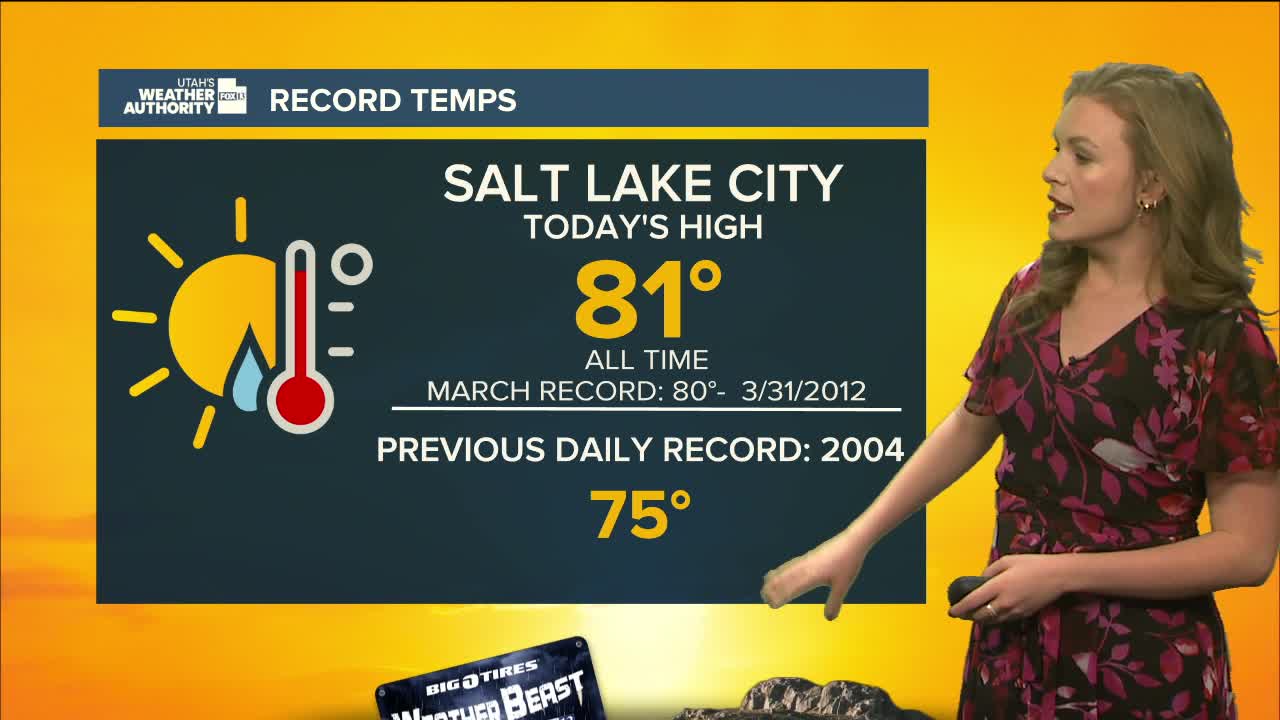


Friday is expected to be even warmer than Thursday, when Salt Lake City hit 81 degrees which is now the earliest 80-degree day on record. Many areas are likely to set new daily temperature records again.
Temperatures will dip slightly on Saturday, but most of northern and western Utah will still be 20 to 30 degrees warmer than usual. Eastern valleys could see even hotter readings thanks to a shift in winds.
A dry cold front will move in Sunday, bringing a brief cool-down. Highs will be 10 to 15 degrees lower in northern Utah and up to 10 degrees cooler in southern Utah. Still, afternoon temperatures will remain 10 to 20 degrees above normal.
Early next week, high pressure is expected to return, pushing highs back toward record levels. The week will stay mostly dry, with unusually warm air being the big weather story.
