

High pressure remains in control across much of the Southwest this evening, while a busy jet stream stays parked well to our north. Temperatures are running well above average once again, though a few degrees cooler than Friday.
That ridge of high pressure will slowly slide east over the weekend. By Monday, a weakening weather system moves into the region, which should mainly bring an increase in cloud cover across our neck of the woods.
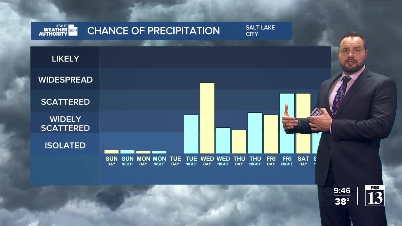
Things get a little more interesting midweek. A strong jet stream pushing into the Pacific Northwest Monday and Tuesday will help shift winds over northern Utah, ushering in some changes. Light precipitation may develop across far northern Utah late Tuesday into Tuesday evening, with heavier showers expected Tuesday night into Wednesday.
Wednesday looks to be the wettest day, with moderate to heavy precipitation likely across northern Utah. The pattern should remain fairly active into the weekend, stay tuned.
