

It's going to be warm, but not too hot! It's easy to see why so many of you say September is your favorite month!
Most showers & t-storms today will be south of the I-80 corridor and most likely across Central & Southern Utah. But monsoonal moisture will continue to surge north, bringing increasingly widespread showers & t-storms through the weekend. Heavy rain is most likely Friday & Saturday along with slightly cooler temps.
Any slow-moving storms with prolonged heavy rain could lead to an even higher threat of flash flooding or even urban flooding. Storms will decrease Sunday, then it'll dry out early next week.
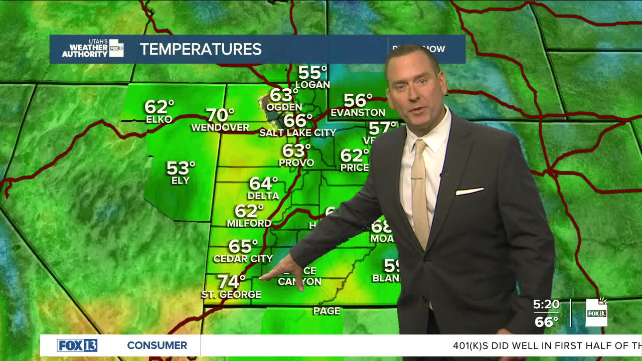
SALT LAKE CITY
Thursday: Partly cloudy with a 10% chance of showers & t-storms thunderstorms in the afternoon. Highs: Upper 80s.
Thursday Night: Mostly cloudy with a slight chance of t-storms. Lows: Mid 60s.
ST. GEORGE
Thursday: Partly cloudy. A few showers possible in the morning, but showers & t-storms most likely in the afternoon & evening. Highs: Low 90s.
Thursday Night: Mostly cloudy with a slight chance of showers & t-storms after midnight. Lows: Near 70.
