

Spring is starting to look like winter again!
A storm bringing rain & snow across Central & Southern Utah will move east of the area by the middle of the day. Most precipitation will wind down by then, although isolated showers could pop up across most of the area this afternoon.
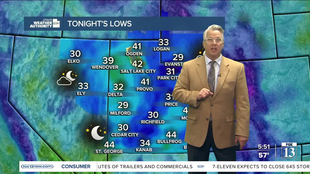
With cold air in place behind the storm, temps are expected to drop below freezing across parts of Central, Southern, & Eastern Utah overnight. If there are any plants you need to protect, make sure you cover them up or bring them inside.
Wednesday is going to be the warmest day of the week! Temps will climb near 70 along the Wasatch Front and into the mid 70s in Lower Washington County.
Don't get used to it! An even colder storm moves in on Thursday with a strong cold front sliding south across the area. Widespread precipitation is expected with rain in the valleys mixing with snow on Thursday and then changing entirely to snow by the evening and into Friday morning. At first, it would melt off from the roads pretty quickly but there could be accumulations impacting the commute on Friday morning. Here's an idea of how much we might get:
Northern Valleys: 1-3 inches
Wasatch Back: 2-5 inches
Northern Mountains: 6-12 inches
This weekend it'll dry out and warm up well above average. So, the spring roller coaster ride continues!
SALT LAKE CITY
Tuesday: Partly cloudy with a slight chance of rain showers in the afternoon. Highs: Upper 50s.
Tuesday Night: Mostly clear. Lows: Near 40.
ST. GEORGE
Tuesday: Isolated showers possible in the morning, then sunny this afternoon. Highs: Near 70.
Tuesday Night: Mostly clear. Lows: Mid 40s.
