

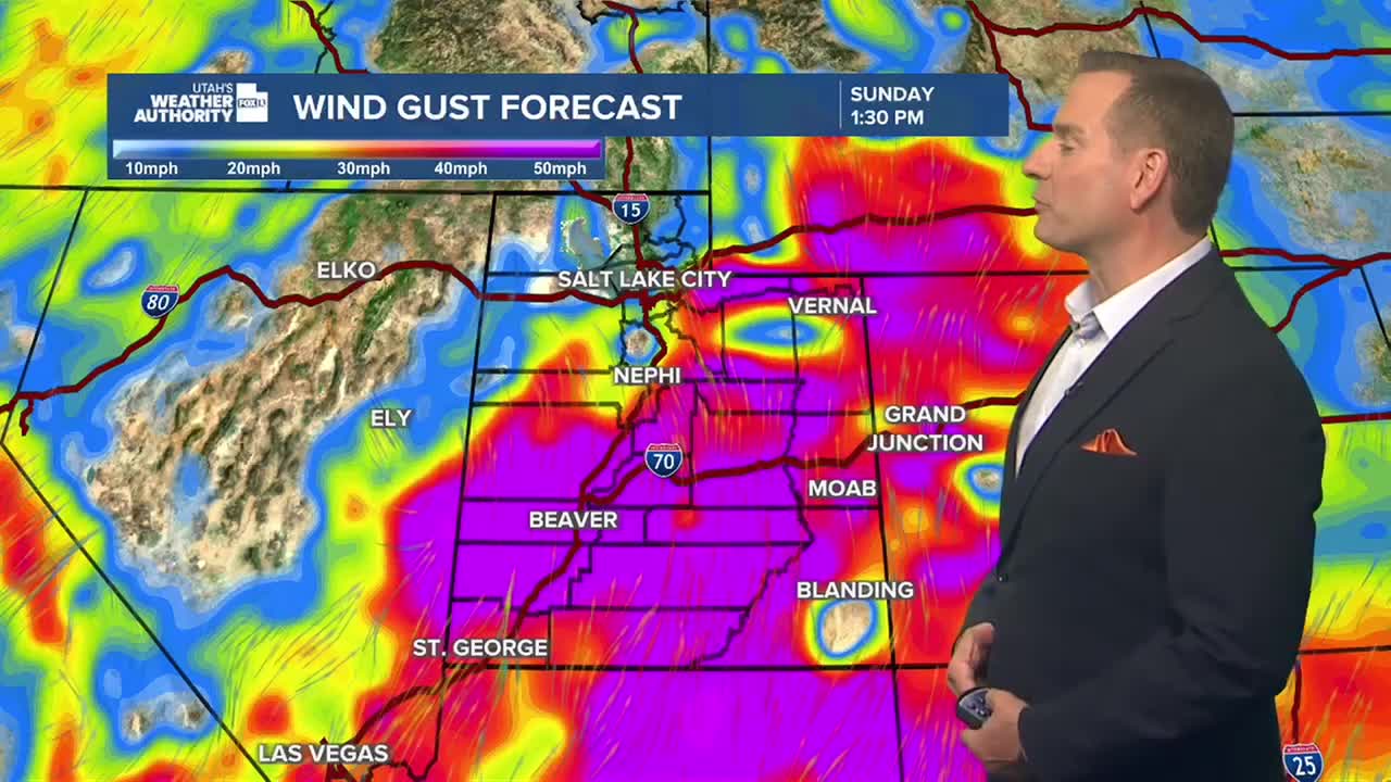

SALT LAKE CITY — Strong winds, heavy rain and flash flooding concerns will continue across Utah as the remnants of Tropical Storm Rachel interact with a slow-moving storm system. Mountain snow and the season’s first freeze are also possible before drier weather returns later this week.
Strong Winds Expected Across Northern Utah
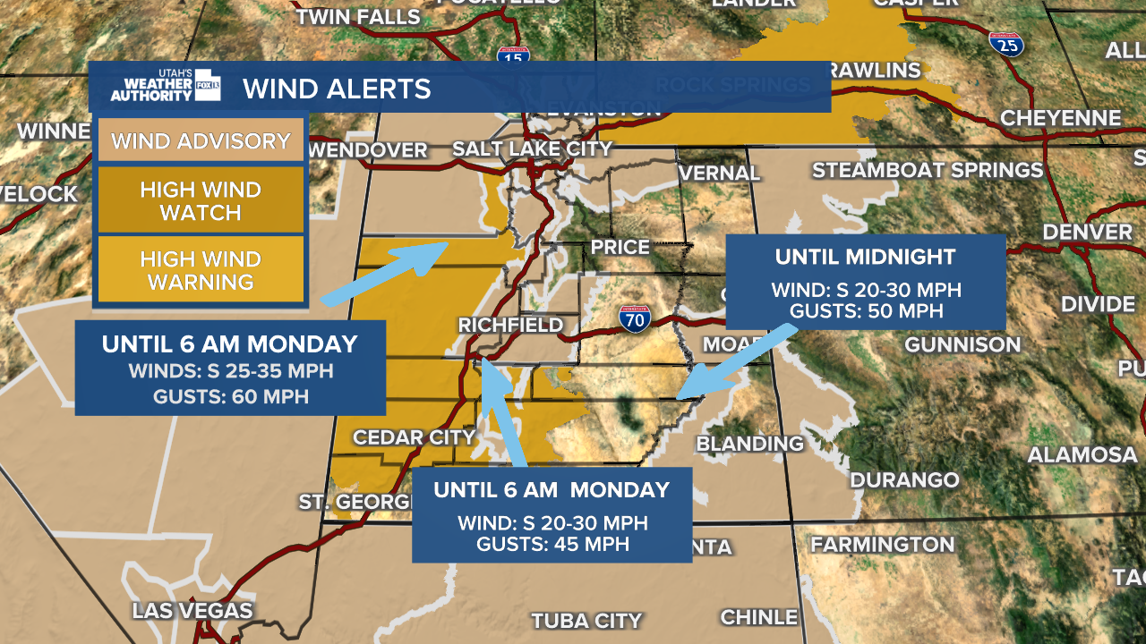
Wind gusts of 45 to 55 mph are expected across northern Utah valleys this afternoon and evening, with gusts of 60 to 75 mph in the mountains and locally exceeding 80 mph along exposed ridgelines.
The National Weather Service has issued Wind Advisories across much of northern Utah and a High Wind Warning for Tooele Valley. Isolated gusts near 60 mph are also possible in parts of the Salt Lake Valley and Wasatch Back.
Heavy Rain Raises Flash Flood Concerns
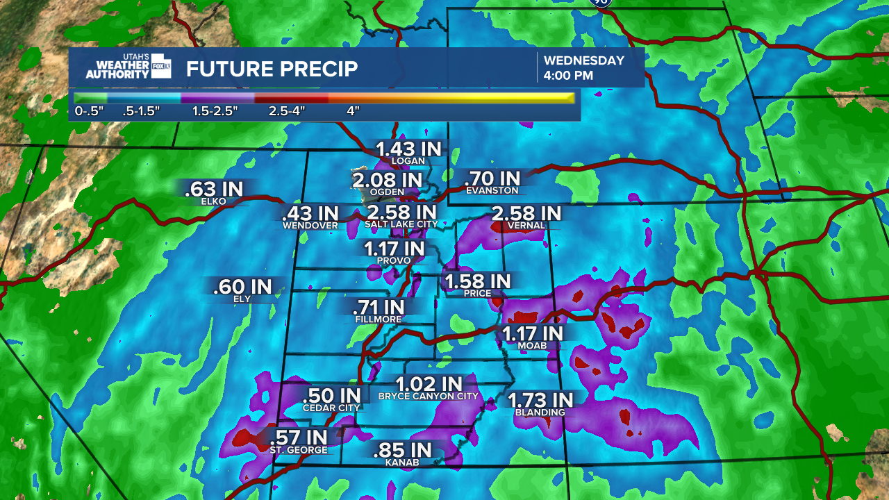
Additional rain is expected along the Wasatch Front this evening as the storm system moves through. Southern Utah remains especially vulnerable to flash flooding after rainfall totals exceeded 3 inches in parts of the Pine Valley Mountains. Flash flooding has already been reported near the Forsyth Burn Scar.
Another 1 to 2 inches of rain could fall in some lower-elevation locations, with heavier amounts possible in the mountains. Burn scars, slot canyons and normally dry washes face an increased risk of dangerous runoff through the evening and into the coming days.
Mountain Snow and Freezing Temperatures Possible
Showers and thunderstorms are expected to redevelop statewide Monday, with the National Weather Service highlighting a Slight Risk for excessive rainfall. Flooding could continue to affect burn scars and other vulnerable locations.
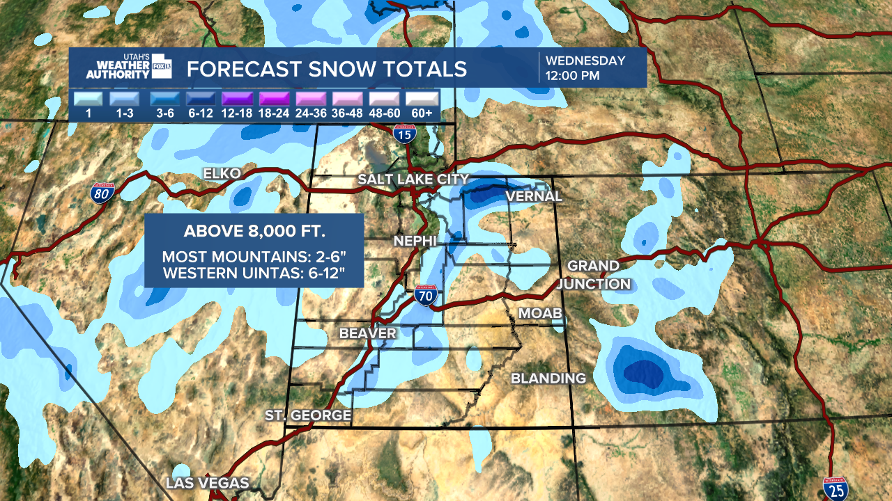
Colder air arriving Monday night through Tuesday could bring accumulating snow to the Uinta Mountains and upper Cottonwood Canyons, primarily above 8,000 feet.
The first freeze of the season is also possible in parts of central and southwestern Utah, particularly the Sanpete and Sevier valleys and portions of Iron and Beaver counties.
Drier Weather Ahead
High pressure is expected to build into the region during the latter half of the week, bringing warmer and drier conditions after several days of active weather.