

SALT LAKE CITY — Utah’s winter has been running behind schedule this year, with warm and dry weather hanging on well into December. Bare mountain slopes, hikers in shorts, and a noticeable lack of early-season snow have many people asking the same question: Where is winter?
The short answer? A stubborn weather pattern that just won’t budge.
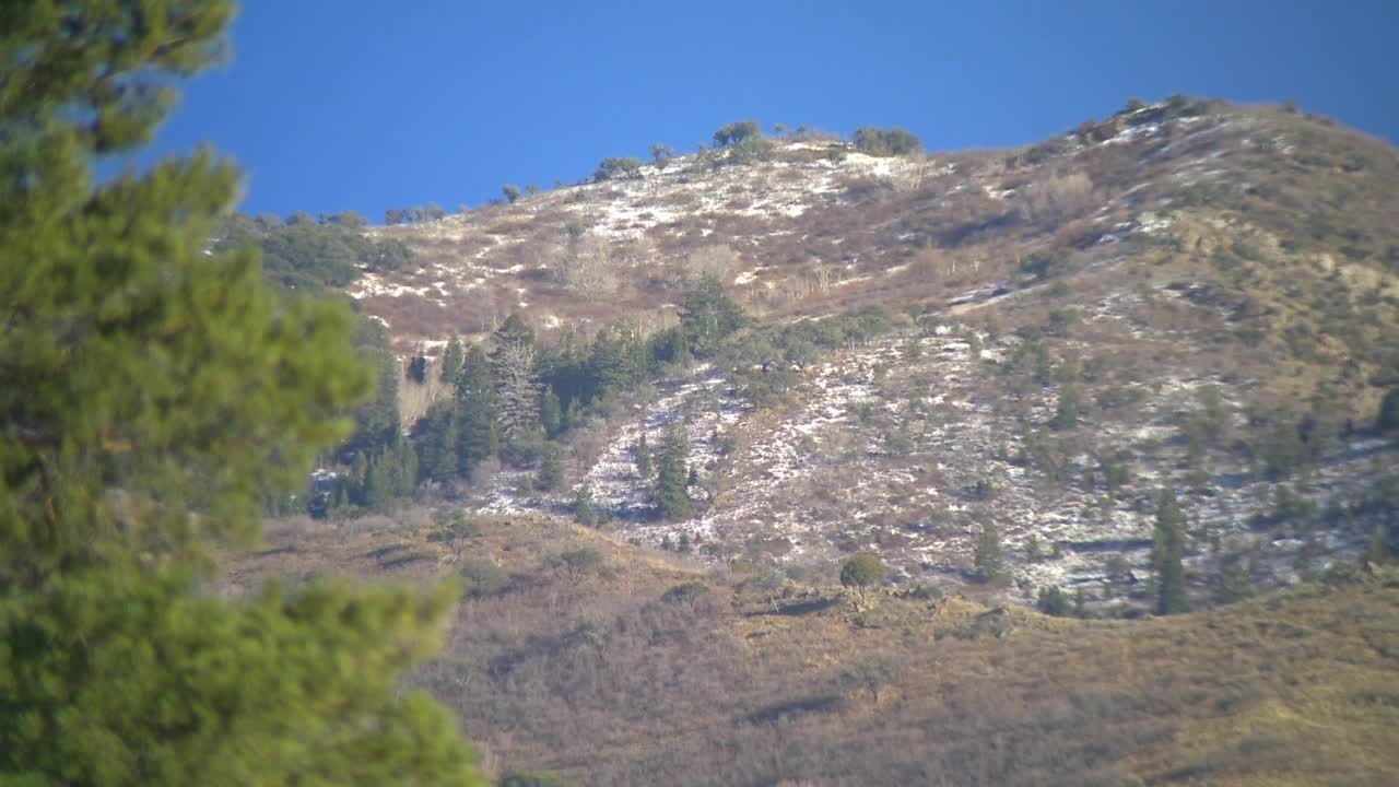
At the mouth of Parleys Canyon, the slow start to winter is easy to see. Hillsides that are usually snow-covered by now remain mostly bare, and outdoor enthusiasts have been taking advantage of the mild conditions instead of digging out the snow shovels.
Meteorologists say a strong ridge of high pressure has been parked over the western U.S. for weeks, deflecting storms well north of Utah. It’s a pattern commonly associated with La Niña winters.
“This tends to slow down the atmosphere’s forward momentum,” said Jon Meyer, Assistant State Climatologist. “It really develops a ridge of high pressure off the West Coast, and that deflects a lot of the storm activity into the Pacific Northwest.”
Unusually warm weather extends golf season for Utahns:
That ridge is tied to cooler-than-normal sea surface temperatures along the equator, which influence global circulation patterns and ultimately steer storm tracks away from Utah.
“We’re in an area that experiences feast or famine when it comes to winter storms,” Meyer said. “There’s a lot of variability from year to year depending on how the Pacific, Atlantic, and Arctic patterns all connect.”
Utah isn’t alone in the slow start. Much of the western United States is also below normal for snowfall so far this season. Some areas of the Pacific Northwest are seeing record moisture, but much of it is falling as rain — even above ski resort elevations.
“At least here in Utah, we’re still cold enough to hold onto the snow we do get at the resorts,” said National Weather Service meteorologist Hayden Mahan. “In some places, snow is being melted away by rain.”
Looking back over the past 50 years, Utah has only seen lower snowpack at this point in the season once — in 2018.
“We’re obviously not thrilled to be this far behind,” Meyer said. “But we’re also not panicking. We’re not expecting a banner snowpack, but there’s still time.”
Mahan echoed that cautious optimism, noting Utah typically doesn’t reach peak mountain snowpack until early April.
“We still have over three months to play catch-up,” he said. “But the longer these dry periods last, the more impressive future storms will need to be to make up the difference.”
The good news? Weather patterns like this don’t last forever. Once the high-pressure ridge breaks down, colder air and storms can move in quickly. And there’s a small silver lining: without frequent valley snow, temperature inversions haven’t been as severe or long-lasting so far this winter.
