

Active pattern into the workweek, valley rain, and mountain snow showers for the Beehive State.
Rain has filled in along much of the Wasatch Front this morning and will continue to expand through the day, with the steadiest precipitation favoring northern Utah. Snow levels will remain relatively high—generally above 7,000 feet—keeping most valley locations in the rain, while the mountains pick up several inches of fresh snowfall. Winds will also be a factor, with breezy to occasionally gusty conditions developing, especially across western and southern Utah with the passing system.
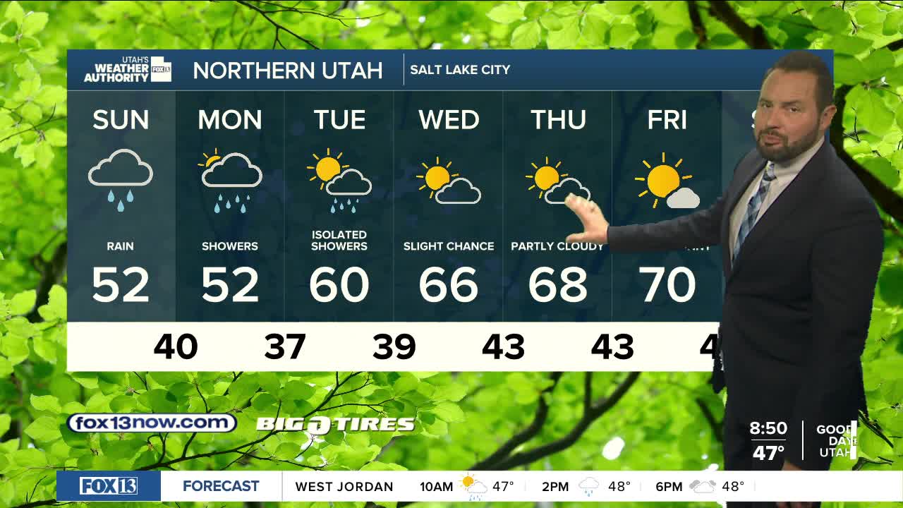
Temperatures will run cooler than what we’ve seen recently, adding to the more unsettled feel after the recent stretch of warmth. Daytime highs will trend 10-15 degrees cooler than normal through Monday, with gradually warming taking place after that through midweek. The pattern stays active into early Tuesday, particularly for the northern mountains, where periods of snow and rain will linger. Travel over higher elevation passes could become slick at times.
By midweek, conditions begin to settle down, with drier weather and a gradual warming trend returning to the state into the weekend.
