
Warming trend continues on Sunday with mostly clear skies. High pressure is overhead through Tuesday, keeping conditions dry and bringing a noticeable warm-up to the state. Highs will climb 5 to 15 degrees above normal today, then jump to 10 to 20 degrees above average Monday and Tuesday, pushing many valleys into early summer-like warmth. Some moisture rotating through the ridge Monday could bring a bit more cloud cover, otherwise, dry weather continues.
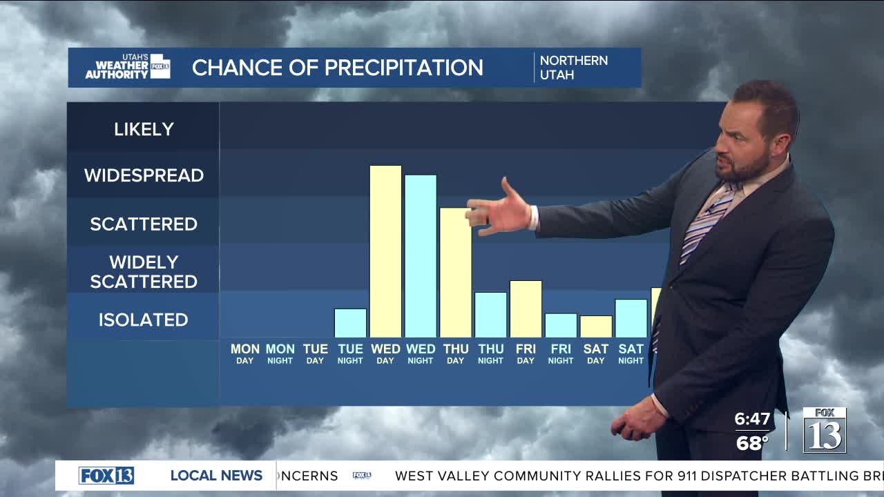
By Tuesday, winds increase ahead of the next storm system. Gusts of 25 to 40 mph are likely across much of the state, with western Utah seeing the strongest winds and a chance for gusts over 45 mph. This is ahead of a cold front that arrives on Wednesday, bringing cooler temperatures and a return to unsettled weather.
Showers are expected to develop, with a slight chance of thunderstorms if the timing lines up during the day. Snow levels will drop from around 7,000 feet to near 6,000 feet behind the front, with northern Utah seeing the best chance for precipitation and some light mountain snow.
Behind the front, cooler and unsettled conditions may linger into late week, with a small chance for lake-enhanced showers and even patchy freezing temperatures in some areas. The broader pattern stays active into next weekend, meaning that slightly unsettled weather will stick around into the weekend as well.
