SALT LAKE CITY — Most of Utah was put under severe weather warnings or advisories Sunday and Monday as a storm system moved in bringing snow, rain, wind and freezing temperatures.
INTERACTIVE RADAR: Click here to track the storm as it moves across Utah
The National Weather Service reported at 5 a.m. Monday, Alta-Collins had already received 17 inches of snow, while Brighton Crest received 14 inches. Mountains in Logan received 11 inches and Snowbird got 12 inches.
LIVE: Check out snow falling in the Salt Lake Valley
Salt Lake and Utah counties did not receive much snow overnight Sunday as was originally predicted because temperatures did not drop as expected. Most of the moisture came down as rain in the overnight hours.
Parts of Salt Lake County saw more snow on Monday afternoon, which made for slick road conditions.
Dugway schools as well as Ogden schools implemented a two-hour delayed start as snow was cleared from the roads.
Check what schools have weather-related closings or delays
By Sunday night, the wintry weather had already caused some crashes.
"Snow is starting to impact several major roadways, and our troopers are already busy with crashes across the state," Utah Highway Patrol Col. Michael Rapich tweeted. "If you are on the road tonight or tomorrow expect extremely slick roads and heavy winter conditions. Thanks for slowing down and helping us keep you Safe!"
Read: More than 20 passengers injured after bus crash near Tremonton
Garland Fire, Tremonton Fire Department (Ambulance), and Utah Highway Patrol responded to a 4-vehicle accident on I-15 Northbound at mile marker 385. 4 total patients were transported with injuries ranging from minor to moderate. #GarlandFire #SeatBeltsSaveLives pic.twitter.com/MTDA951gIn
— Garland Fire Department (@garlandfireut) December 12, 2022
Road restrictions were put in place for Utah mountain roads including Big Cottonwood Canyon and in Wasatch County. If you do have to travel through the canyons, make sure your vehicle is equipped for the weather.
In Logan, slick roads contributed to a crash that killed 52-year-old Angela Givens.
Police said a pickup truck was traveling southbound on 1000 West at 900 South when the driver, Givens, lost control and was broadsided by an SUV traveling northbound.
There were no other passengers in either of the vehicles and the Givens was taken to the hospital where she passed away.
The storm is expected to drop up to 2 feet of snow in some areas like the northern mountains, while the central and southern mountains may possibly receive up to 18 inches of snow. Valleys in northern Utah could get between 2-6 inches of snow before the system moves on.
Everyone will see a fair share of snow from the next storm. Initially rain will fall but transition to snow tonight. Expect a messy Monday morning commute. pic.twitter.com/jO3s6QYbnE
— Brek Bolton (@brekbolt) December 11, 2022
The Salt Lake City office of the National Weather Service has placed a large portion of northern Utah under a Winter Weather Advisory until 11 a.m. Tuesday.
Areas under the advisory until 11 a.m. Tuesday:
- Bear River Valley
- Cache Valley
- Eastern Box Elder County
- Northern Wasatch Front
- Rush Valley
- Salt Lake Valley
- Tooele Valley
Parts of southern and south-central Utah, along with the Western Uinta Mountains and Sanpete County Valley, are also under a Winter Storm Advisory through 11 a.m. Monday.
Meanwhile, a Winter Storm Warning has been issued for higher elevations around the state, especially in the Wasatch Mountains and southern mountain areas. Snow accumulation will approach or exceed 2 inches per hour for a time between 5 p.m. Sunday through 8 a.m. Monday.
Find the latest warnings and advisories for your area on our weather alerts page.
TRACK THE STORM: Get real-time storm information by downloading the FREE Utah Weather Authority app
The storm system began with rain arriving throughout the day on Sunday, but it changed to snow Sunday evening. It's expected to become extra heavy at times through 4-6 a.m. Monday.

A High Wind Warning was also in effect for the Tooele and Rush valleys, as well as southwest Utah, until 8 p.m. Sunday. A Wind Advisory was in place until the same time for several areas, including the Salt Lake Valley.

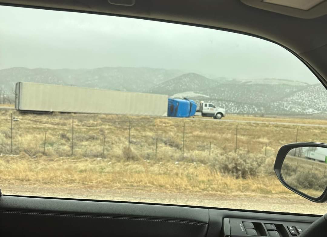
A semi-truck was blown over Sunday by 60 miles per hour winds on Interstate 15 just north of Cedar City. Near Magna, a 76-mile-per-hour wind gust was measured where SR-201 meets I-80.