

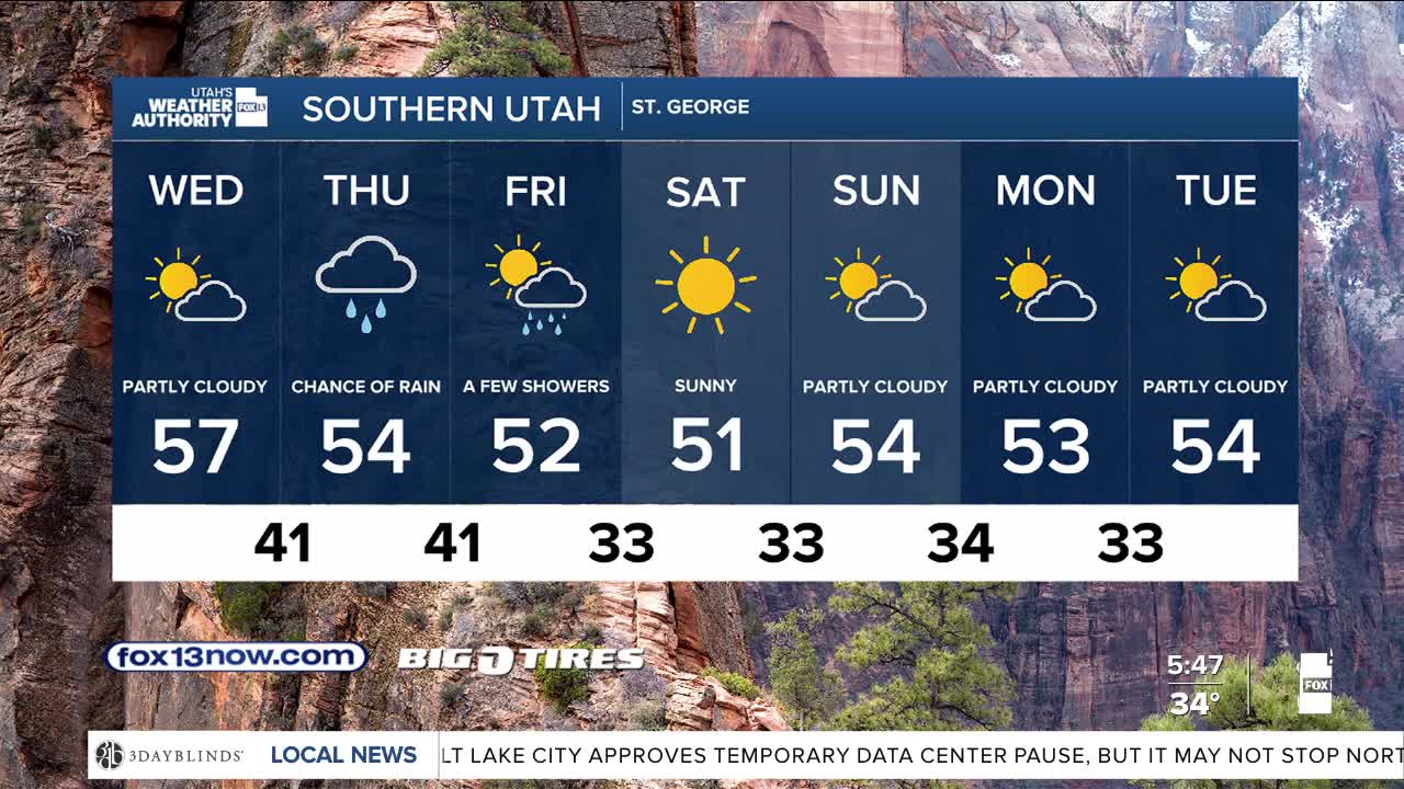


You might need your winter coat! Cold air in place behind yesterday's storm is going to keep it chilly today.
After a sunny start across most of Utah, clouds will be increasing later today ahead of the next storm that will cross Utah on Thursday & Friday.
The next storm will bring more valley rain & with the potential for significant mountain snow. Another 6-12 inches are possible in the Northern Mountains, although close to 2 feet will be possible in the upper Cottonwoods. 4-10 inches are expected over the Central & Southern Mountains. Snow levels will likely drop below 5,000 ft. by Friday with minor accumulations possible on the valley floor.
It should dry out this weekend, but get even colder!
SALT LAKE CITY
Wednesday: Sunny in the morning, then becoming partly cloudy. Highs: Mid 40s.
Wednesday Night: Becoming mostly cloudy. Lows: Mid 30s.
ST. GEORGE
Wednesday: Sunny in the morning, partly cloudy in the afternooh. Highs: Upper 50s.
Wednesday Night: Becoming mostly cloudy. Lows: near 40.