

Happy Weekend, Utah!
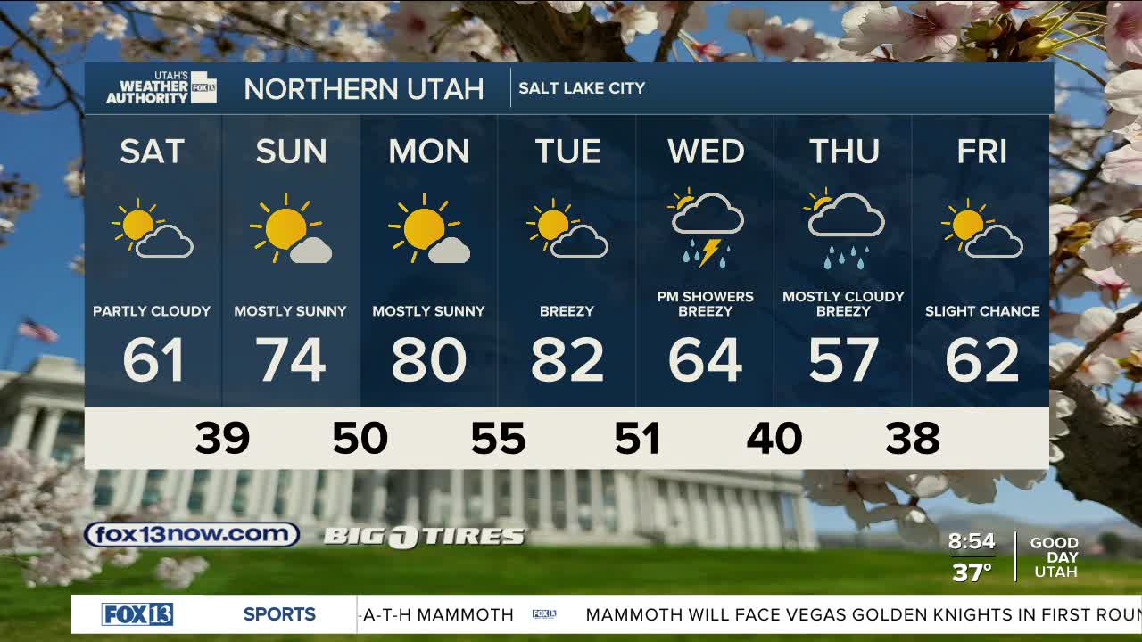
We're warming up this weekend as high pressure builds into the region. The pattern shift will bring a stretch of mostly dry weather into early next week. Temperatures will climb back above normal by Sunday, with the warmest days expected Monday and Tuesday. In northern Utah valleys, highs are forecast to reach the mid-70s to low 80s. Far southern Utah will heat up even more, with lower valleys pushing into the mid to upper 80s.
The quiet stretch won’t last long. A series of weather systems is expected to move through Utah starting Wednesday and continuing into late next week. That shift will bring cooler temperatures and a return to more unsettled conditions. While the exact timing and strength of each system is still uncertain, increasing southerly winds are likely to develop by Tuesday ahead of the first system. Snow levels during this round of active weather are expected to stay relatively high, generally above 6,000 to 7,000 feet, meaning most valleys will see rain rather than snow. Stay tuned.
