

GUNNISON, Utah — A new report shows that there are even more fault lines through central Utah than previously thought, and the report's author is calling it a "game changer."
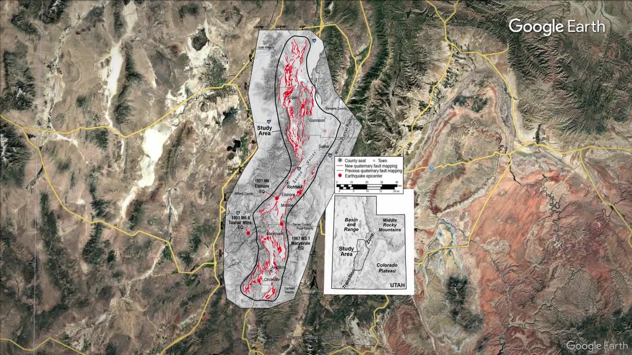
A new technology called Lidar, which is basically data collected from radar on an airplane flying above, mapped out the six-county region in the central part of the state.
"It digitally allows us to see through vegetation so we can actually see what the surface of the earth looks like under vegetation," said state geologist Adam Hiscock.
The report centered around Richfield, exposing the risk in the rural regions that include Sanpete, Millard and Sevier counties.
"We were able to map and identify numerous faults that were previously not mapped," Hiscock said. "A lot of these cross major transportation corridors and infrastructure lines."
Earthquake shakes things up in small town on Utah-Wyoming border:
Sevier County Sheriff Nathan Curtis said, "We’re in earthquake country, and we’ve got to be prepared, especially when it comes to water and gas lines and potential power outages.”
Curtis suggests local residents download a new app just launched in Sevier County that will send push notifications and contact you in case of an emergency, because the best line of defense is thinking about a potential disaster and having a plan ahead of time.
You know, I’ve actually never thought about it, so I probably should," said Paige Conover, a Gunnison resident and mother of 3.
Another website, beready.utah.gov, is another great resource when it comes to preparedness. Experts also suggest having an emergency kit ready to grab and a plan in place for you and your family, since we all live in earthquake country.
