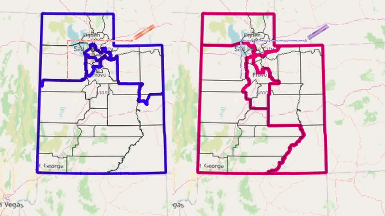


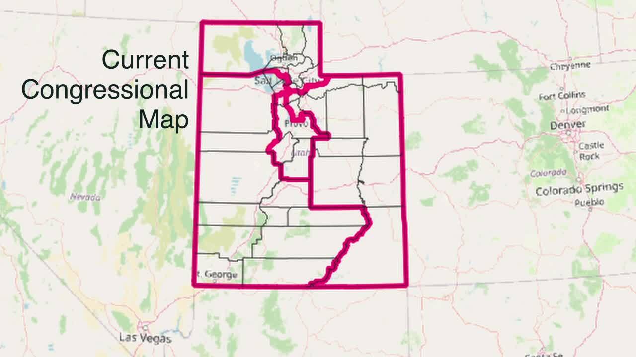
SALT LAKE CITY — Currently, all four of Utah's congressional districts converge within a few blocks in Millcreek. In one location, districts 1, 2, and 3 are delineated by a small canal and 39th South. Just 10 blocks away, districts 1, 2, and 4 meet at the intersection of 3900 South and 900 East.
Picture four friends from the same local middle school with all four sets of parents registered in separate congressional districts. The official reasoning behind it is the idea that every representative serves urban and rural areas. Unofficially, it separates the most Democratic parts of the state four ways, making each district a Republican stronghold.

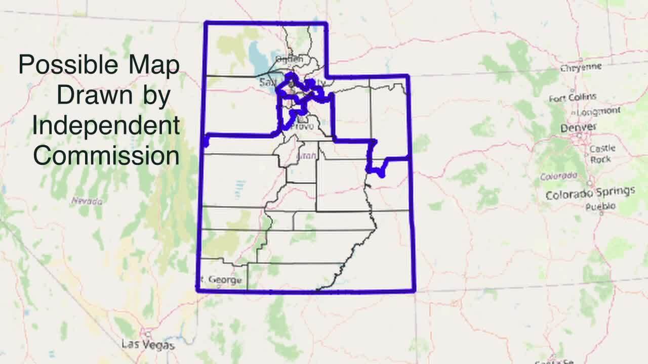
In this story, we used one of the three maps proposed by Utah's Independent Redistricting Commission after the 2020 Census. Voters approved an initiative creating the commission to take partisanship out of drawing districts, but the legislature quickly amended the voter initiative to take map-drawing power back.
The commission's proposal draws four districts anchored by different cities, with Ogden-Clearfield and Logan in a geographically expansive northern district, Provo and St. George in an even bigger (by land area) southern district.
In between, the commission drew two compact districts. One includes the southern cities of Davis County and northern Salt Lake County, including Salt Lake City and West Valley City. The other extends from West Jordan and Cottonwood Heights to the North to American Fork and Eagle Mountain to the South.

On Monday, a judge sided with the groups that challenged the legislature's maps. Click here to read more.
