

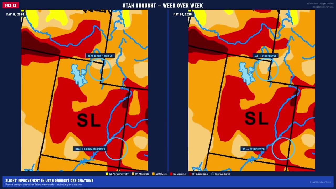


The latest weekly drought map shows slight improvement in two areas of Utah when comparing the map from May 19 to the one released covering the week through May 26.
Neither change has significance for Utah's larger drought dilemma, but it provides a chance to talk about what does and doesn't matter when measuring drought.
One area of improvement is around Bear Lake. To understand why, it helps to think less about state and county lines and more about watersheds.
The National Water Dashboard, watersheds tell a more complete water story. For residents of Rich County, for example, the water picture is more closely connected to communities in Idaho and Wyoming than to other parts of Utah. The Bear River region saw a slight improvement last week.
Drought, low snowpack may push moose closer to neighborhoods, as seen in Springville:
The second area of improvement is along the Utah-Colorado border, in the Upper Colorado Dolores watershed subregion. That area includes Monticello and Blanding. The improvement is modest — those communities are not suddenly flush with water — but in southeastern Utah, a small boost is meaningful in a region that has seen very little relief.